Showing 1974 results
Loading...

Edited by:
Massimo Martini
Lavachey, from Planpincieux
Itinerario di fondovalle che risale la Val Ferret da Planpincieux fino al piccolo villaggio di Lavachey, con rientro sullo stesso...
7.59 Km
0 m

Edited by:
Marcello Rossi
Gressoney Blue Lake, from Staffal
Salita al lago Blu di Gressoney, meno famoso dei due laghi ononimi della valle d'Ayas e di Valturnanche, ma ugualmente...
0.00 Km
0 m
Edited by:
Massimo Martini
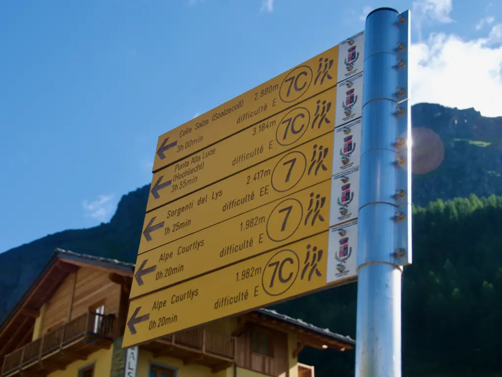
High Light, from Staffal
Itinerario di andata e ritorno che sale alla vetta dell'Alta Luce (Hochlicht, 3.184m), collocata sulla dorsale che divide il ghiacciaio...
T2
12.92 Km
1409 m
Edited by:
Marcello Rossi
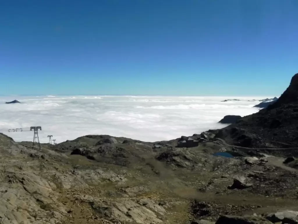
Col d'Olen, from Staffal
The Col d'Olen is located along the Tour du Monte Rosa and connects the Gressoney valley with Valsesia, from the...
0.00 Km
1135 m
Edited by:
Massimo Martini
Rothorn Pass, from Staffal
A pleasant, panoramic hike on the left-hand side of the upper Lys valley. The ascent to the Rothorn Pass is...
T2
10.00 Km
903 m

Edited by:
Giancarlo Beretta
Castor, from Staffal
The ascent to the Castore is a mountaineering classic and consequently very popular: without any particular technical difficulties, however, it...
F+
0.00 Km
1497 m

Edited by:
Alberto Rota
Bettaforca Pass, from Staffal
This itinerary starts from Staffal and leads to the Colle della Bettaforca, the pass point towards the Val d'Ayas, along...
T2
10.80 Km
850 m

Edited by:
Maurizio Bergamini
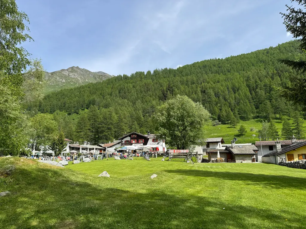
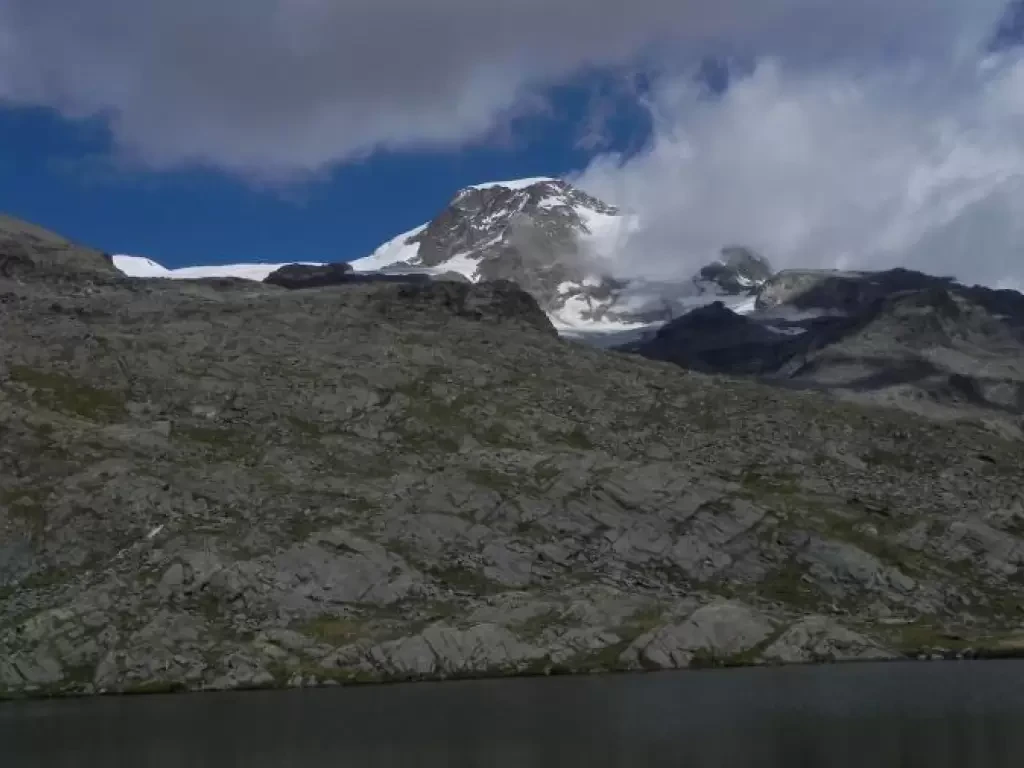
Sorgenti del Lys
Passeggiata panoramica, che raggiunge l'attacco del ghiacciaio del Lys. In caso di bel tempo il panorama è grandioso su tutto...
T2
6.00 Km
1177 m
Edited by:
Massimo Martini
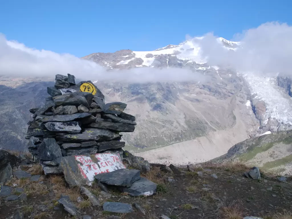
Punta Telcio, from Staffal
Punta Telcio (2833 m), easily recognisable by its obvious avalanche barriers, is located on the south-east side of the Moos...
T3
18.55 Km
1209 m
Edited by:
Massimo Martini
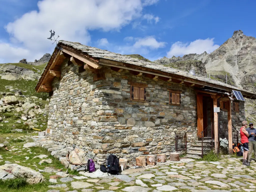
Reboulaz bivouac, from the Porliod car park
The excursion to the Luca Reboulaz bivouac winds its way along the Saint-Barthélemy valley, following farm tracks and paths through...
T2
21.30 Km
824 m
Edited by:
Massimo Martini
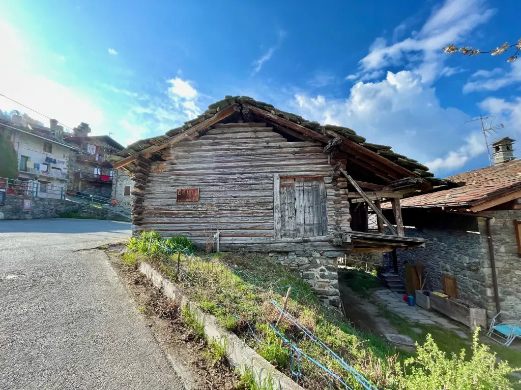
Lenty, from the Roman Bridge of Saint-Vincent
This itinerary takes the hiker to the hilly southern part of Saint-Vincent. The route winds its way through villages, forests...
T2
4.74 Km
429 m
Edited by:
Massimo Martini
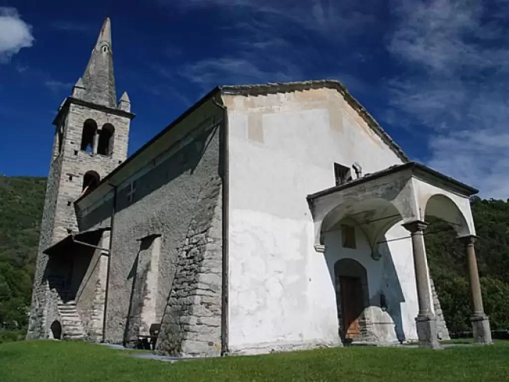
Church of Moron, from the Roman Bridge of Saint-Vincent
Short walk through the woods of the Cillian valley. The destination, the church of San Maurizio (better known as the...
T2
0.00 Km
230 m


