Everest
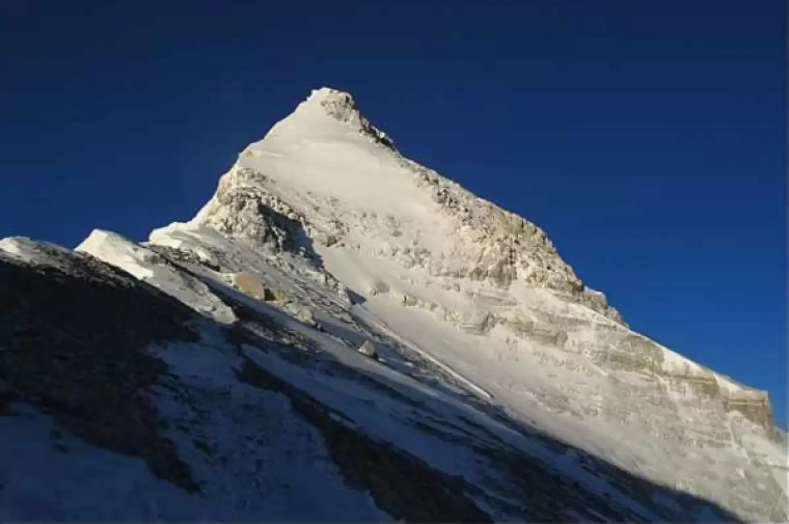

Edited by:
Massimo Martini
Access
TheEverest can be reached from two main sides, each with its own logistics and permit system: the Nepalese side, which offers the standard route up the south-east ridge, and the Tibetan (Chinese) side, which leads to the north-east ridge. Both routes are entirely at high altitude and require a series of camps – typically four in addition to base camp – with acclimatisation stops lasting a total of six to eight weeks. The most critical section on the Nepalese side is crossing the serac field of the Khumbu Glacier, which is exposed to crevasses and serac falls. On the north face, the most technically demanding section consists of the rocky steps of the north-east ridge – the First, Second and Third Steps – where the use of fixed ropes is now standard practice. Both standard routes are classified as PD in terms of mountaineering difficulty, but the extreme altitude, the reduced oxygen levels above 8,000 metres and the weather conditions make every ascent a feat of exceptional magnitude.
Ascent routes
’ from South Base Camp (5,364 m), via the Khumbu Glacier and South Col – PD – 6–8 weeks (including acclimatisation) – (standard route, Nepalese side)
» from North Base Camp (5,200m), via the North Col and north-east ridge – PD+ – 6–8 weeks (including acclimatisation) – (Tibetan side)
» south-west face, British route (1975) – ED – technical ascent on mixed terrain
» east face (Kangshung), American route (1983) – ED – highly difficult route on mixed terrain and ice
Traverses
» Everest–Lhotse traverse
Introduction
At 8,849 metres above sea level, Everest is the highest peak on Earth. It rises on the border between Nepal and Tibet (China) in the central section of the Himalayan range, at the junction between Solukhumbu District to the south and Shigatse Prefecture to the north. It is shaped like a three-sided pyramid, with three main faces – north, east and south-west – separated by three ridges, of which the south-east and north-east ridges form the two historic ascent routes. The name by which the mountain is universally known was introduced in 1865 by the British surveyor Andrew Waugh in honour of his predecessor Sir George Everest, who was in charge of the Great Trigonometric Survey of India; the Tibetan name Chomolungma, ‘mother of the universe’, and the Nepalese name Sagarmatha, ‘god of the sky’, remain the names most deeply rooted amongst the local populations. The peak had already been known as ‘Peak XV’ since 1852, when the mathematician Radhanath Sikdar, whilst analysing data from the Survey of India, first identified it as the highest point on Earth. The first ascent was made on 29 May 1953 by the New Zealander Edmund Hillary and the Sherpa Tenzing Norgay, as part of the British expedition led by Colonel John Hunt; the success was announced to coincide with the coronation of Queen Elizabeth II, immediately becoming an event of global historical significance. In 1978, Reinhold Messner and Peter Habeler made the first ascent without supplementary oxygen, and in 1980 Messner returned to the summit alone, via a new route on the north face, again without oxygen: two of the most significant mountaineering feats of the twentieth century.
Description
Everest occupies a central position amongst the world’s highest peaks. On the Nepalese side, it overlooks the Khumbu Glacier, which descends towards the Khumbu Valley as far as the village of Namche Bazaar, the main commercial centre of the Sherpa region. The border between Nepal and China runs along the western and south-eastern ridges: only the south-western face is therefore entirely within Nepal, whilst the northern and eastern faces lie within the Chinese territory of Tibet. To the west, the Lho La Pass (6,026 m) connects it to Khumbutse (6,636 m); to the east, the South Col (7,906 m) separates it from Lhotse (8,516 m), the fourth-highest peak on Earth; to the north, the North Col (7,066 m) connects it to Changtse (7,543 m). The three glaciers that drain the mountain’s slopes – the Khumbu to the south-west, the Rongbuk to the north and the Kangshung to the east – form part of the third-largest ice mass on the planet, the Himalayan-Tibetan ice system, which comprises around 15,000 glaciers.
From a geological perspective, the structure of Everest reflects the orogenic history of the entire Himalayan range, resulting from the collision between the Indian and Eurasian plates that began some 50 million years ago and is still ongoing. The summit and upper slopes, above approximately 8,600 metres, consist of the Qomolangma Formation, a metamorphic limestone of marine origin dating from the Palaeozoic era, bearing witness to the ancient seabed of the Tethys Ocean. Between 7,000 m and 8,600 m, the Everest Formation outcrops, comprising marbles, phyllites and semi-schists. Below 7,000 metres lies the Rongbuk Formation, comprising schists, gneisses and leucogranitic intrusions. The three formations are separated by gently dipping faults of regional importance, known as the ‘Qomolangma detachment’ and the ‘Lhotse detachment’, through which the various rock layers overlap to form the mountain range. The tectonic uplift, which is still active, causes the summit to rise by a few millimetres each year, a process also influenced by the earthquakes that periodically affect the region: the 2015 earthquake altered the morphology of certain sections of the ridge, including theHillary Step, which was transformed from a vertical rock face into a snow slope.
The flora and fauna at the foot of the mountain in Sagarmatha National Park include species emblematic of theHimalayas, such as the snow leopard (Panthera uncia), the musk deer (Moschus chrysogaster), the wild yak (Bos mutus) and the red panda (Ailurus fulgens). The park is home to 118 species of birds and 26 species of butterflies. The vegetation ranges from forests of rhododendrons, birches and junipers to alpine meadows, right up to the lichens and mosses that extend to around 5,750 metres, the permanent snow line.
The first reconnaissance missions on Everest date back to the British exploration expedition of 1921, led by Colonel Charles Howard-Bury, who identified the north face as the main access route. The following year, in 1922, the second British expedition attempted the summit for the first time: George Finch and Geoffrey Bruce reached 8,321 metres thanks to thepioneering use of supplementary oxygen, but the expedition was marred by the death of seven Sherpa porters in an avalanche. 1924 marked a legendary and unresolved chapter: George Mallory and Andrew Irvine disappeared on 8 June during thefinal attempt to reach the summit; they were last seen by Noel Odell less than 300 metres from the summit. Mallory’s body was found in 1999 at an altitude of 8,290 metres, but the camera that might have provided evidence of his reaching the summit was not found either on him or at the spot where Irvine’s body is presumed to still lie: the matter remains unresolved.
In the decades that followed, the mountain remained inaccessible from Nepal for political reasons, and attempts were concentrated on the north face, then British territory. After the Second World War, Nepal opened its borders to foreign expeditions. In 1952, the Swiss expedition led by Edouard Wyss-Dunant took Tenzing Norgay and Raymond Lambert to 8,595 metres via the south-east ridge, some 250 metres from the summit, before being halted byexhaustion and a lack of oxygen supplies. Success came the following year: on 29 May 1953, at 11.30 am, Edmund Hillary and Tenzing Norgay reached the summit via the south-east ridge, remaining there for about fifteen minutes. The expedition had been organised down to the last detail by the Joint Himalayan Committee and was funded partly for political reasons: the United Kingdom wanted the feat to coincide with the coronation of Queen Elizabeth II, which took place on the very same day. Hillary and Norgay took photographs, buried some sweets and planted a small cross in the snow. On their return to the valley, Hillary said to George Lowe: “We’ve knocked the bastard off."
In the years that followed, there was a surge in ascents, first ascents and new routes. In 1960, a Chinese expedition took mountaineers to the summit via the north face for the first time. In 1963, the Americans Tom Hornbein and Willi Unsoeld completed the first traverse of Everest, ascending via the Hornbein Couloir on the West Ridge and descending via the South-East Ridge – one of the most significant mountaineering feats of the decade. In 1973, the major Italian expedition led by Guido Monzino – comprising 55 military personnel, 8 civilians and 110 tonnes of equipment – took Mirko Minuzzo and Rinaldo Carrel to the summit on 5 May, followed by three other Italian mountaineers on 7 May. In 1975, the British expedition opened a route on the difficult south-west face. In the same year, a Chinese expedition confirmed the height of 8,848 m, and a Japanese climber, Junko Tabei, became the first woman to reach the summit.
The most radical ethical turning point came on 8 May 1978, when Reinhold Messner and Peter Habeler made the first ascent without supplementary oxygen, proving that survival in theextreme ‘Death Zone’ was possible without artificial support: an achievement that high-altitude medicine had deemed impossible. Two years later, between 18 and 20 August 1980, Messner returned to the summit via the north face, alone, via a route linking the north ridge to the Norton Couloir: the first-ever solo ascent of Everest, again without oxygen. The first winter ascent was achieved on 17 February 1980 by the Poles Krzysztof Wielicki and Leszek Cichy, as part of an expedition led by Andrzej Zawada: theEverest thus became the first eight-thousander to be climbed during the winter season.
From the 1990s onwards, the phenomenon of commercial expeditions radically transformed the approach to mountaineering. In 1996, a snowstorm during a bottleneck on the ridge claimed the lives of eight mountaineers, an incident recounted in Jon Krakauer’s bestseller Into Thin Air. In 2019, further queues near the summit resulted in additional fatalities. The fatality rate, estimated at around one in forty attempts in recent seasons, remains among the highest of the eight-thousanders. Over 6,000 mountaineers had reached the summit by the end of 2024, many of them multiple times: the record for the most ascents is held jointly by the Sherpas Apa Sherpa and Phurba Tashi, with twenty-one ascents each.
For the Sherpa people of the Khumbu region, the mountain has always been a place of profound spiritual significance: Chomolungma, ‘mother of the universe’, is not simply a peak to be conquered, but a sacred presence with which to maintain a relationship of respect. Traditional expeditions still begin with the puja, a blessing ceremony officiated by a Buddhist lama at base camp, during which protection is sought from the mountain for the expedition members and the porters. Tradition also dictates that many mountaineers stop one metre below the summit out of respect for the home of the gods. The history of the Sherpa porters is inextricably linked to that of mountaineering on Everest: without their contribution – transport, setting up camps, managing fixed ropes, rescue operations – none of the great feats of the twentieth century would have been possible. Tenzing Norgay, a Sherpa from the Khumbu region, was described by the journalist Pete Boardman as “the first Asian of humble origins to achieve international fame and renown”. Following the first ascent, Edmund Hillary devoted much of his life to founding the Himalayan Trust, which has funded the construction of schools, hospitals and bridges for Sherpa communities.
Everest is the most frequently climbed of the eight-thousanders. The climbing permit issued by the Nepalese government costs 11,000 dollars per climber during the spring season, the main climbing window (April–May). The Chinese government restricts access from the north face to groups authorised through specialist agencies. The autumn season (September–October) offers a second, less crowded window. The overcrowding of standard routes, the massive presence of rubbish and the ethical issues surrounding commercial expeditions are subjects of ongoing debate within the international mountaineering community. Sagarmatha National Park, established in 1976 and designated a UNESCO World Heritage Site in 1979, protects the entire ecosystem surrounding the mountain, including the Sherpa villages of Namche Bazaar and Tengboche.
Information
Information
Elevation: 8,849 m
Alternative name: Sagarmatha (Nepali), Chomolungma (བོད་སྐད), Peak XV (historical)
Mountain range: Central Himalayas
Mountain range: Himalayas
Type: rocky pyramid / main summit
Protected area: Sagarmatha National Park (Nepal) / UNESCO World Heritage Site
First ascent: 29 May 1953
First ascenders: Edmund Hillary, Tenzing Norgay
First winter ascent: 17 February 1980
First winter ascenders: Krzysztof Wielicki, Leszek Cichy
Summit logbook: none
Municipality/ies: Solukhumbu (Nepal) / Shigatse (Tibet, China)
Valley/ies: Khumbu Valley (S), Rongbuk (N)
Mountaineering difficulty: PD (normal routes); ED (walls)
Average elevation gain: 3,485 m (from South Base Camp)
Recommended period: April–May; September–October
Predominant aspect: S-W (Nepalese side); N (Tibetan side)
Glaciers: yes (Khumbu, Rongbuk, Kangshung)
Equipped sections: yes (fixed ropes on both standard routes)
Support facilities: Pyramid International Laboratory and Observatory (5,050 m) – Italian research station on the Nepalese side
Base camp: Khumbu Lodge – South Base Camp (5,364 m)
Collections
country high points – list – map
peaks in Sagarmatha National Park – list – map
peaks of the Mahalangur Himal – list – map
peaks of theCentral Himalayas – list – map