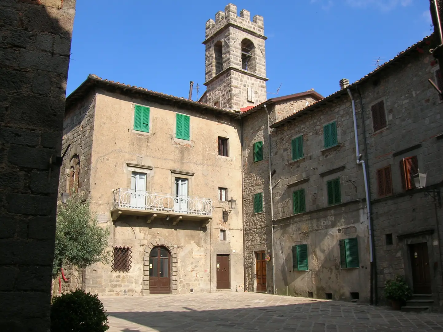
Abbadia San Salvatore

Access
The municipality of Abbadia San Salvatore can be reached along the Strada Statale 2 Cassia if coming from Siena or Rome, with detours along well-connected provincial roads. Those travelling by car can also refer to the Chiusi-Chianciano Terme exit of the motorway, from which it is about 45 kilometres along a scenic hilly route. The nearest railway station is Chiusi-Chianciano Terme, connected to the centre by regular bus services; alternatively, there is a dense network of bus services from Grosseto, Siena and the main Umbrian cities. The nearest airports are Florence-Peretola (approx. 140 km), Rome Fiumicino/Leonardo da Vinci (approx. 190 km) and Perugia-San Francesco d'Assisi (approx. 110 km), all of which can be reached by hire car or public transport.
.Introduction
Abbadia San Salvatore is a municipality located in the south-east of the province of Siena, in Tuscany, positioned on a slope on the eastern slopes of Monte Amiata. The village lies on a hilly plateau at about 822 metres above sea level, framed by beech and chestnut woods that determine its landscape identity. The village owes its name to the historic Benedictine abbey founded in the 8th century, which for centuries was a centre of spirituality and power. The urban fabric preserves a clearly recognisable medieval imprint, interwoven with evidence of the mining era and a lively cultural tradition that makes Abbadia one of the most significant centres in the Amiata area for its cultural offerings, naturalistic value and the presence of services dedicated to excursion hospitality.
.Description
Dominated by the presence of Mount Amiata, an ancient extinct volcano and the second highest peak in Tuscany (1,738 m), the municipal territory is distinguished by its mountainous environment. The main watercourses are the Paglia and the numerous streams that descend rapidly towards the Val d'Orcia, creating varied landscapes and habitats favourable to Alpine and Apennine flora and fauna. The Amiata forest, rich in centuries-old chestnut trees, has historically provided support for the local economy along with timber and fruit harvesting. Abbadia is famous for the Abbey of San Salvatore, founded, according to tradition, in 743 by the Lombard king Ratchis; one of the best-preserved historical nuclei of the Sienese area, a medieval crossroads of trade, culture and pilgrimage, grew up around the abbey. Since the 19th century, the development of the cinnabar mine - one of the main ones in Italy - has profoundly marked the local history, giving Abbadia a singular urban and social stratification: the mining memory is today preserved and valorised through the Mining Museum Park. In addition to the mining industry, traditional handicrafts (wood, textiles and food processing) and a solid tourist-hiking vocation have survived.
The current economy is mainly based on tourism and services related to mountain activities, with a seasonality that favours both summer tourism - thanks to the Amiata Park trails, the numerous picnic areas and religious tourism - and winter tourism, thanks to the ski facilities and snowshoe excursions to the summit. The gastronomic heritage includes chestnuts, mushrooms, honey and typical handmade pasta dishes, including the traditional 'pici' and 'castagnaccio'. The patronal festivals and festivals, such as the 'Fiaccole' on 24 December, emphasise the collective identity with an evocative interweaving of ancient rituals and intense community participation. There are numerous excursion itineraries that lead to refuges and panoramic points, such as the summit of Mount Amiata, a destination for walkers and hikers, and the route of the Via Francigena that crosses the surrounding lands. Legend has it, moreover, that some of the woods in the area have been the refuge of hermit saints and, according to popular tradition, a land of mysterious presences linked to the rural and monastic world.
Information
Area: 58.99 km²
Altitude: 822m
Maximum elevation: 1,738m - Monte Amiata
Number of inhabitants: 6,120 as of 31.12.24
Name in dialect: Badia
Inhabitant name: abbadenghi
Patron Saint:St. Mark Pope, celebrated on September 19
Bordering municipalities: Castel del Piano, Castiglione d'Orcia, Piancastagnaio, Radicofani, San Casciano dei Bagni, Santa Fiora, Seggiano
Internet site: www.comune.abbadia-san-salvatore.siena.en
Points of Interest
- Monte Amiata
Collections
cover: Piazza Santa Croce, Abbadia San Salvatore, Province of Siena, Tuscany, Italy - 26 August 2009, 16:58:11 - Patafisik