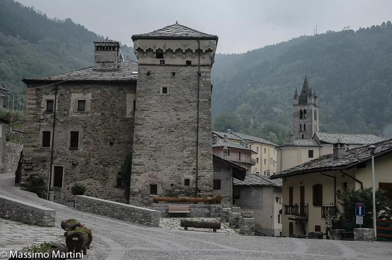
Avise

Introduction
A town in the central valley, west of Aosta, strategically located on the orographic left of the course of the Dora. It is said to have been inhabited by the Salassi, but it is to the Romans that it owes its toponym and its most characteristic corner, described and immortalised in prints and paintings over the centuries (the watercolour by the English painter Turner is very famous).Description
Information sheet
Area: 52.62 square km
Altitude: 775m
Maximum elevation:
Number of inhabitants: 340
Name in dialect:
Inhabitant name:
Patron Saint:
Internet site:
Webcam:
Neighbouring municipalities: Arvier, La Salle, La Thuile, Saint-Nicolas, Saint-Pierre, Saint-Rhémy-en-Bosses,Valgrisenche
Villages and hamlets:
Landscapes:
Description
A village in the central valley, west of Aosta, strategically located on the orographic left of the course of the Dora. It is said to have been inhabited by the Salassi, but it is to the Romans that it owes its toponym and its most characteristic corner, described and immortalised in prints and paintings over the centuries (the watercolour by the English painter Turner is very famous).
In fact, the Roman road of Gaul passed through Avise and, to overcome the narrow gorge that characterises the territory of the village, the ancient engineers had to resort to the chisel and have a path dug halfway up the hillside: La Pierre Taillée, which historically constituted the last bulwark in defence of the city of Aosta against foreign invasions coming from the Petit St. Bernard or the Col du Mont, in the upper Valgrisenche. The seigniory of Avise is very old, perhaps predating Savoy rule over the Aosta Valley: the first lord whose name is known is Hugo, who took an oath to Emperor Henry IV in 1091.
The strategic importance of Avise is confirmed by the fact that it was a strategic stronghold. The strategic importance of the village is confirmed by the presence of no less than three castles within a short distance of each other: the Avise Castle, the Blonay and the house-fort Le Cré, also known as Ducrest.
Despite its location near a narrow gorge, the economy of Avise enjoys ample space in the mountain above it, which extends as far as the 'comba' (valley) of Vertosan, still very favourable for cattle breeding, while the lower mountain area is exploited for viticulture with the production of a renowned Petit Rouge.
A village in the central valley, west of Aosta, strategically located on the orographic left of the course of the Dora. It is said to have been inhabited by the Salassi, but it is to the Romans that it owes its toponym and its most characteristic corner, described and immortalised in prints and paintings over the centuries (the watercolour by the English painter Turner is very famous).
In fact, the Roman road of Gaul passed through Avise and, to overcome the narrow gorge that characterises the territory of the village, the ancient engineers had to resort to chiselling and have a path carved halfway up the mountainside: La Pierre Taillée, which historically constituted the last bulwark defending the city of Aosta against foreign invasions coming from Piccolo San Bernardo or Col du Mont, in the upper Valgrisenche. The seigniory of Avise is very old, perhaps predating Savoy rule over the Aosta Valley: the first lord whose name is known is Hugo, who took an oath to Emperor Henry IV in 1091.
The strategic importance of the village is confirmed by the presence of no less than three castles at a short distance from each other: the castle of Avise, the Blonay and the house-fort Le Cré, also known as Ducrest.
Despite its location near a narrow gorge, the economy of Avise enjoys ample space in the mountain above it, which extends as far as the 'comba' (valley) of Vertosan, still very favourable to cattle breeding, while the lower mountain area is exploited for viticulture with the production of a renowned Petit Rouge.
In fact, the Roman road of Gaul passed through Avise and, to overcome the narrow gorge that characterises the territory of the village, the ancient engineers had to resort to the chisel and have a path dug halfway up the hillside: La Pierre Taillée, which historically constituted the last bulwark in defence of the city of Aosta against foreign invasions coming from the Petit St. Bernard or the Col du Mont, in the upper Valgrisenche. The seigniory of Avise is very old, perhaps predating Savoy rule over the Aosta Valley: the first lord whose name is known is Hugo, who took an oath to Emperor Henry IV in 1091.
The strategic importance of Avise is confirmed by the fact that it was a strategic stronghold. The strategic importance of the village is confirmed by the presence of no less than three castles within a short distance of each other: the Avise Castle, the Blonay and the house-fort Le Cré, also known as Ducrest.
Despite its location near a narrow gorge, the economy of Avise enjoys ample space in the mountain above it, which extends as far as the 'comba' (valley) of Vertosan, still very favourable for cattle breeding, while the lower mountain area is exploited for viticulture with the production of a renowned Petit Rouge.
Information
Superficie: 52,62 kmq
Altitudine: 775m
Maggior elevazione:
Numero abitanti: 340
Nome in dialetto:
Nome abitanti:
Santo Patrono:
Sito internet:
Webcam:
Comuni confinanti: Arvier, La Salle, La Thuile, Saint-Nicolas, Saint-Pierre, Saint-Rhémy-en-Bosses,Valgrisenche
Villaggi e frazioni:
Alpeggi: