Monterosahutte


Edited by:
Giancarlo Beretta
Updated at: 16/06/2025
Access
Dall’Italia si raggiunge, passando per il valico del Sempione o del Gran San Bernardo, il canton Vallese in Svizzera e si percorre l’autostrada e, terminata questa, la statale in direzione Visp; prima di entrare nella cittadina si trova una rotonda con le indicazioni per Zermatt che si seguono sino ad arrivare al comune di Täsch. Qui si deve lasciare l’auto nei grandi parcheggi e raggiungere la stazione ferroviaria per prendere il trenino per Zermatt; giunti nella stazione della bella località alpina si raggiunge, appena usciti sulla sinistra, la stazione della ferrovia del Gornergrat e, preso il trenino, si scende alla fermata di Rotenboden.
Introduction
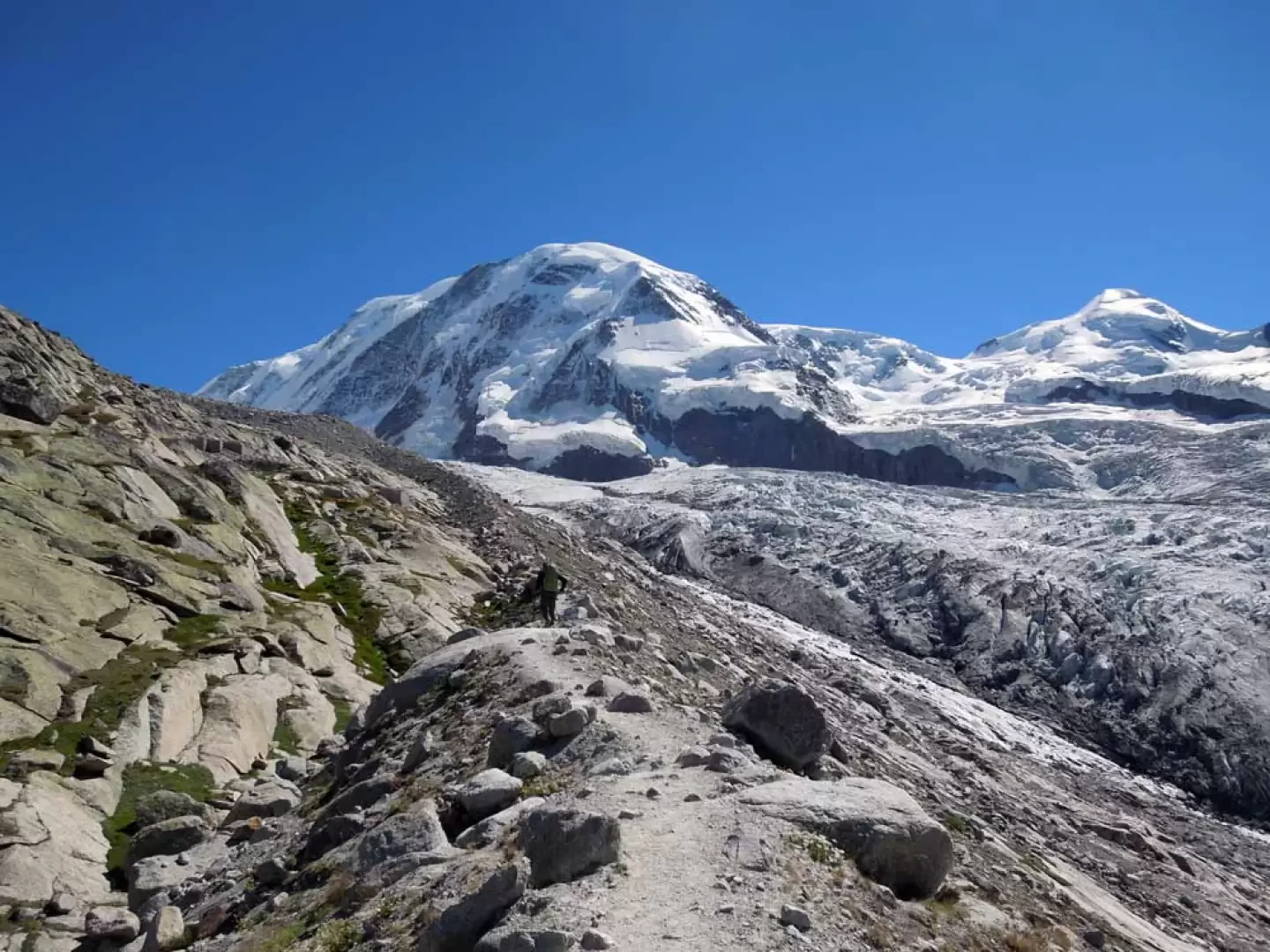
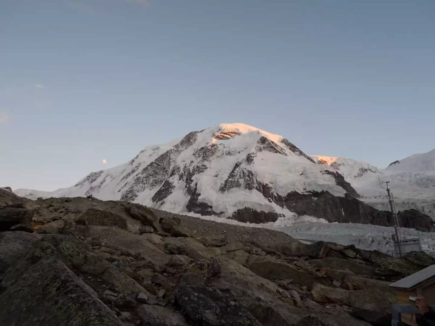
Il nuovo rifugio Monterosahutte è stato edificato un centinaio di metri al di sopra di quello precedente ed è un moderno edificio costruito con tecnologie avanzate e con la facciata completamente ricoperta da pannelli solari; esso è situato su una larga dorsale morenica in una posizione da cui si gode un panorama veramente eccezionale sulla corona di 4000 che circondano Zermatt, un po’ chiuso solo verso est dalla cresta del Gornergrat. Il suo raggiungimento comporta il passaggio di alcuni esposti tratti attrezzati e l’attraversamento di un tratto con saliscendi di un ghiacciaio che presenta alcuni passaggi un po’ delicati tra i crepacci. Le difficoltà possono quindi variare sia a seconda del periodo sia per condizioni del ghiacciaio e dei tratti attrezzati che, valutate al momento, devono essere affrontate con attenzione da escursionisti abituati alla progressione su questi tipi di terreni.
Description
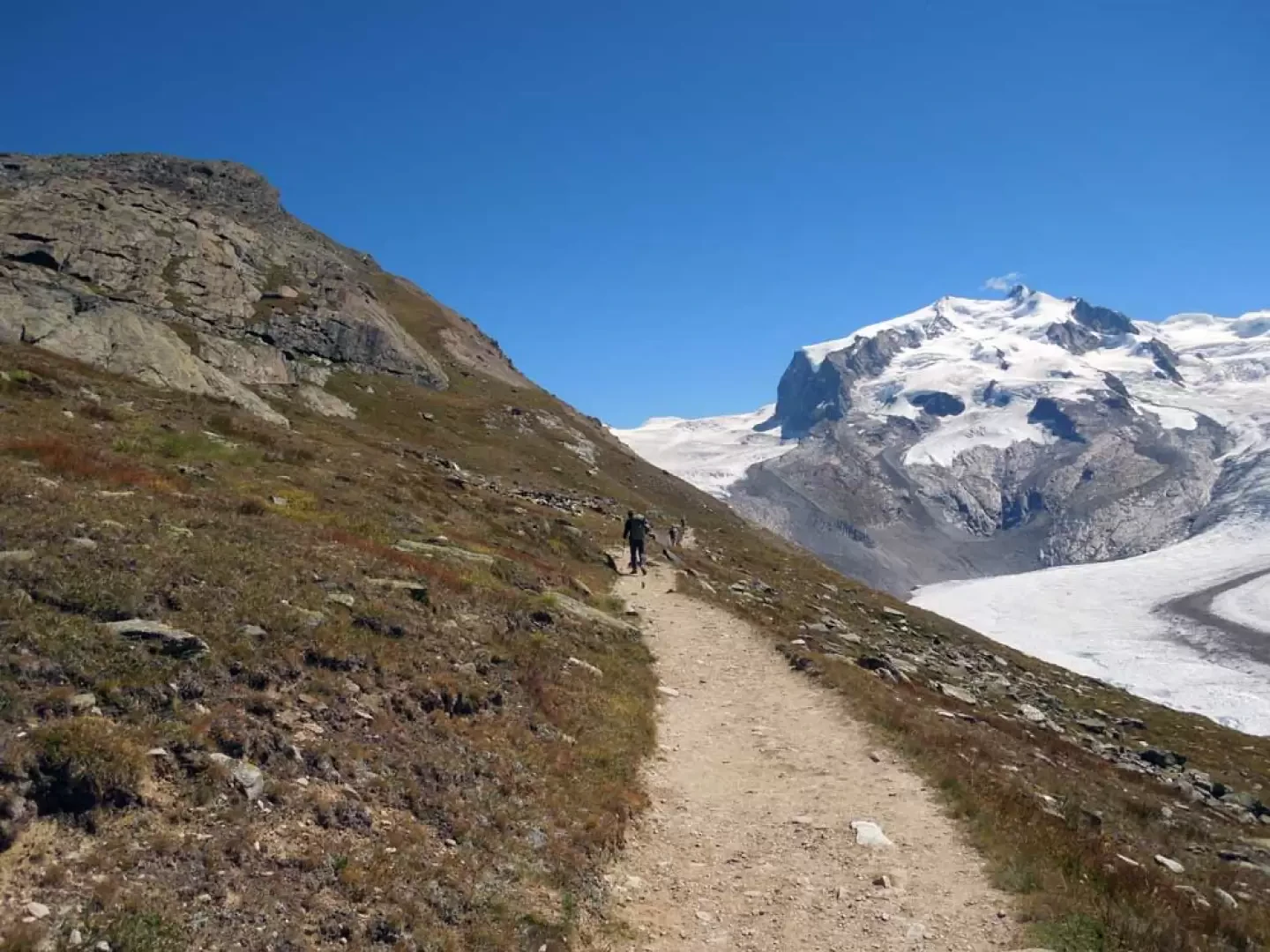
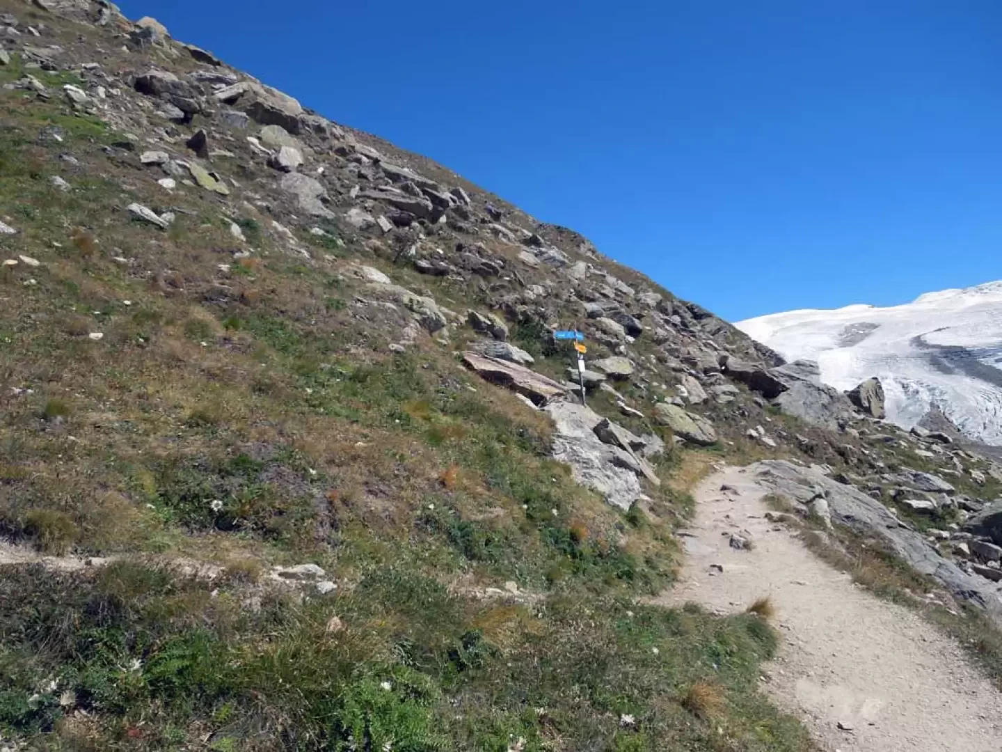
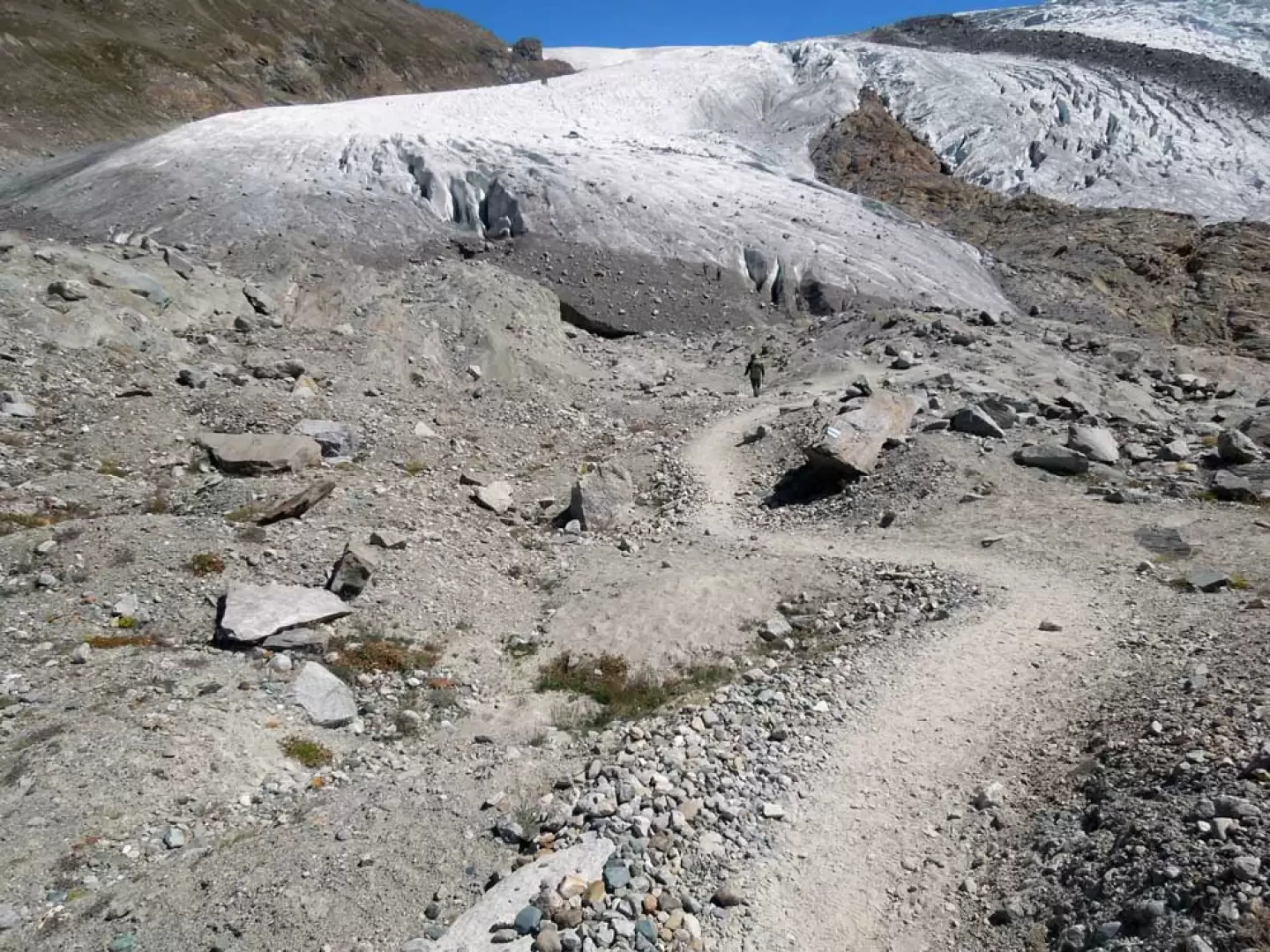
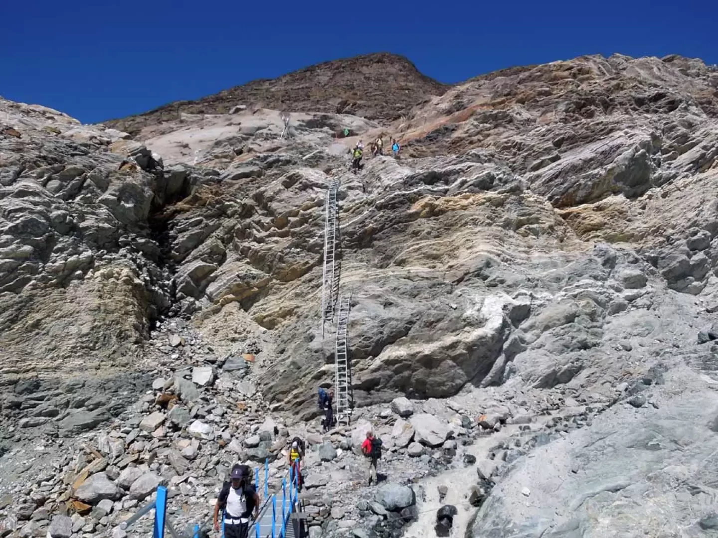
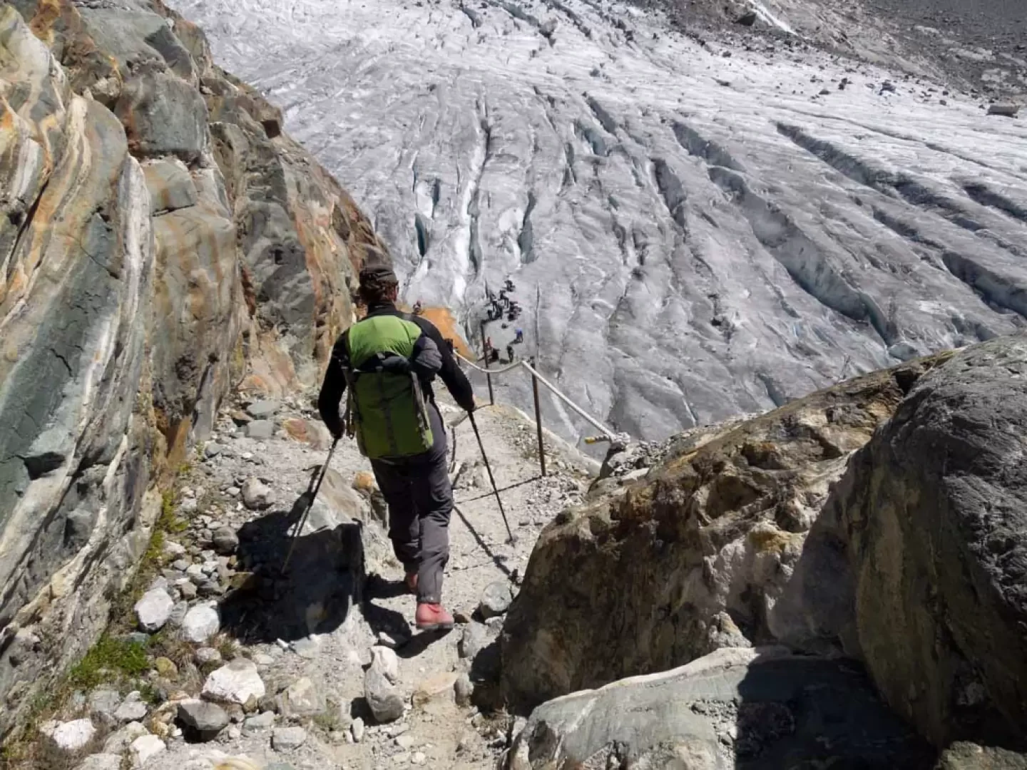
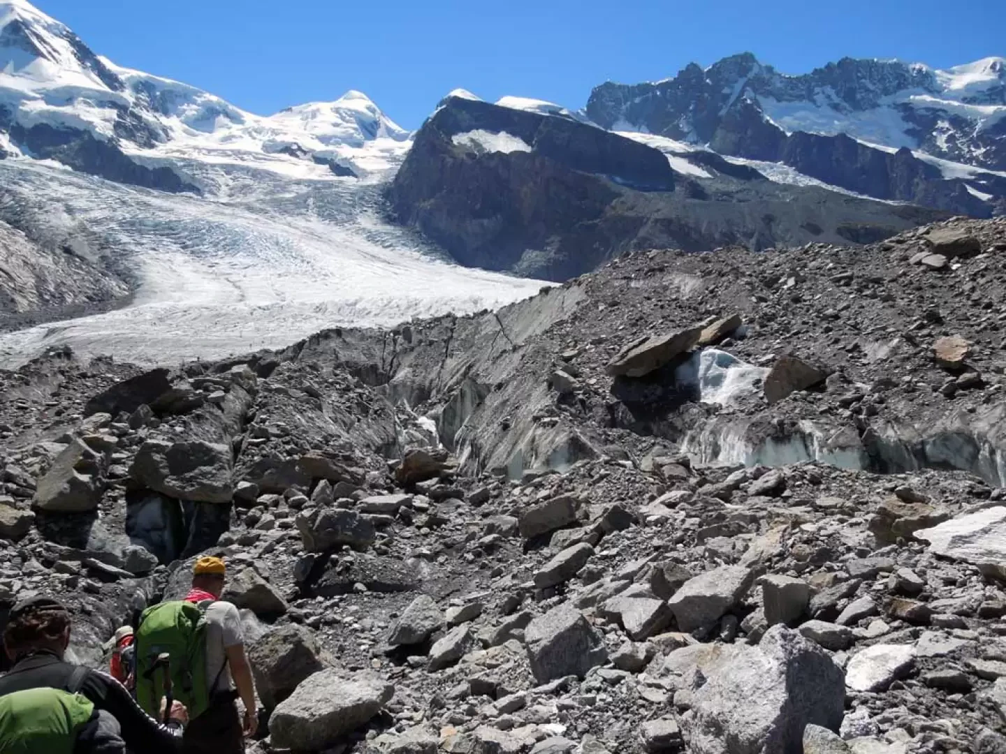
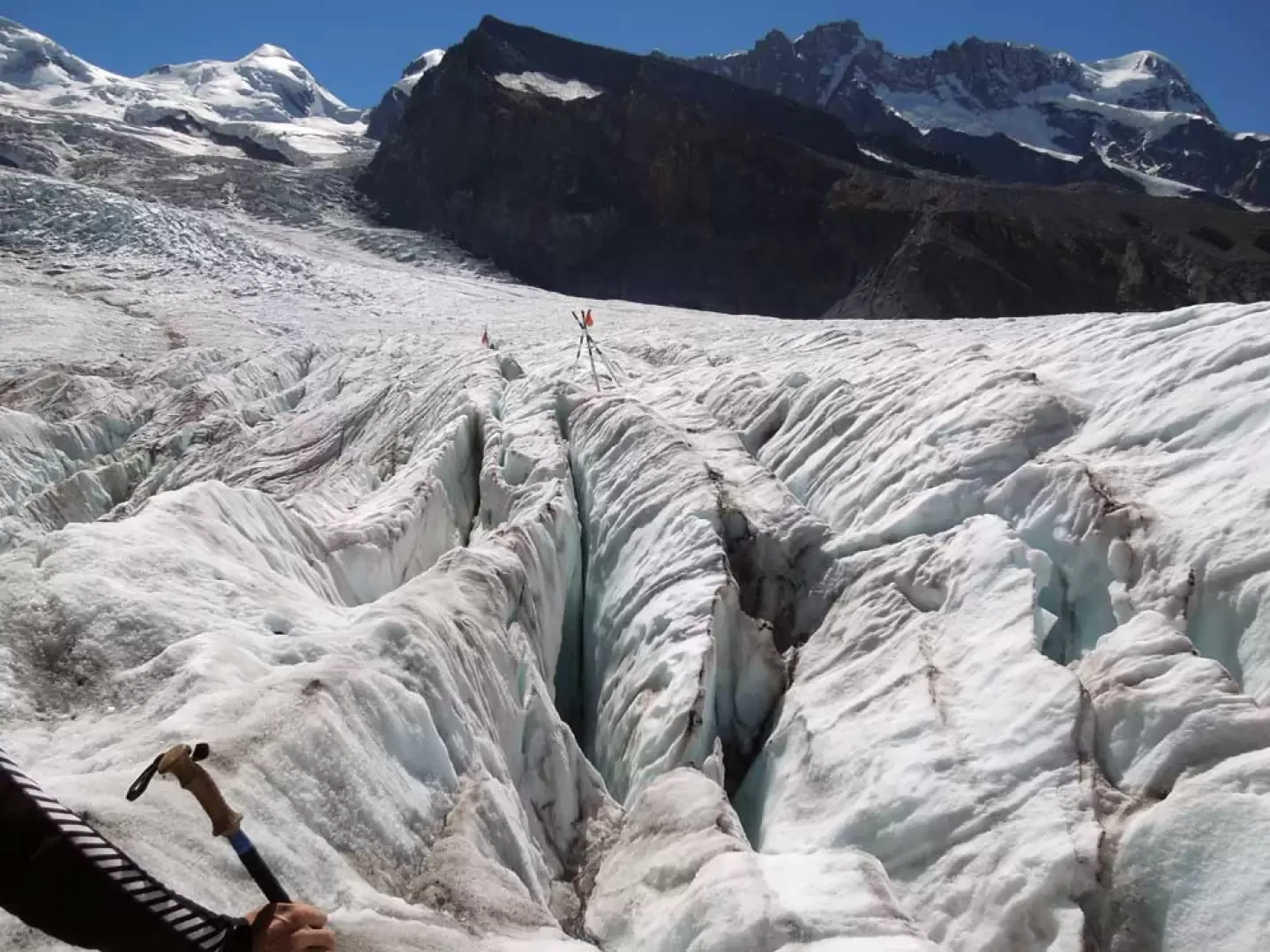
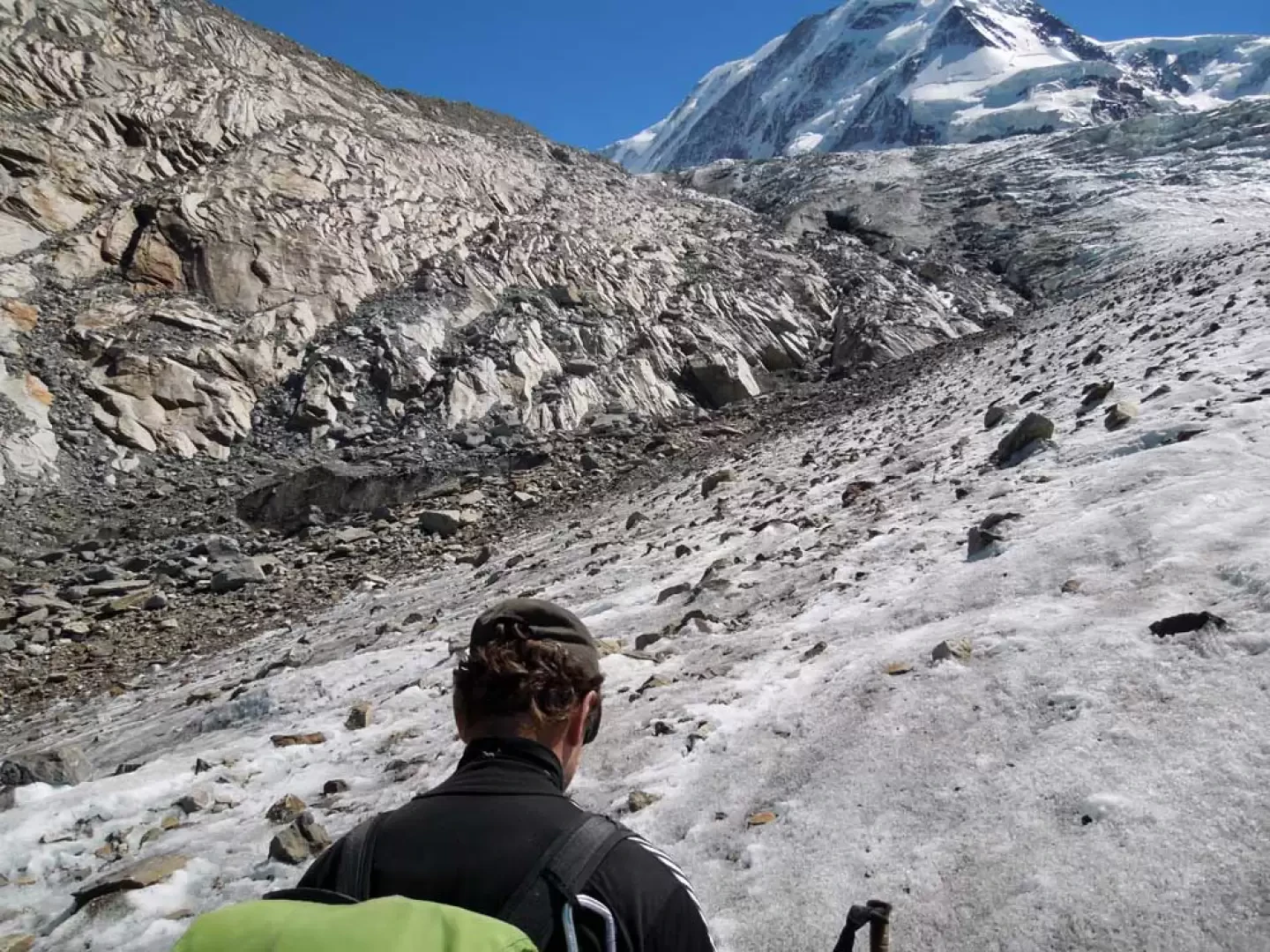
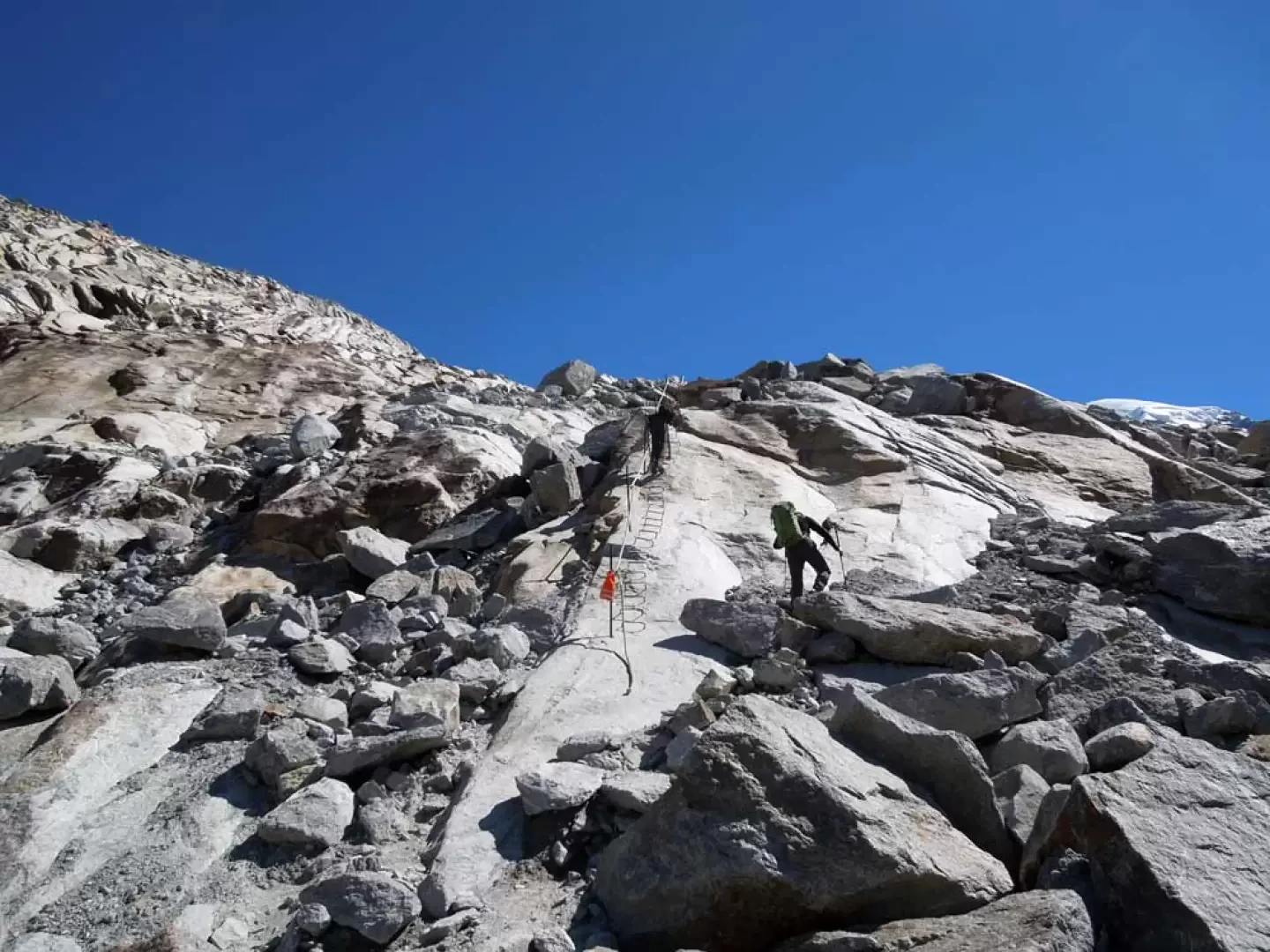
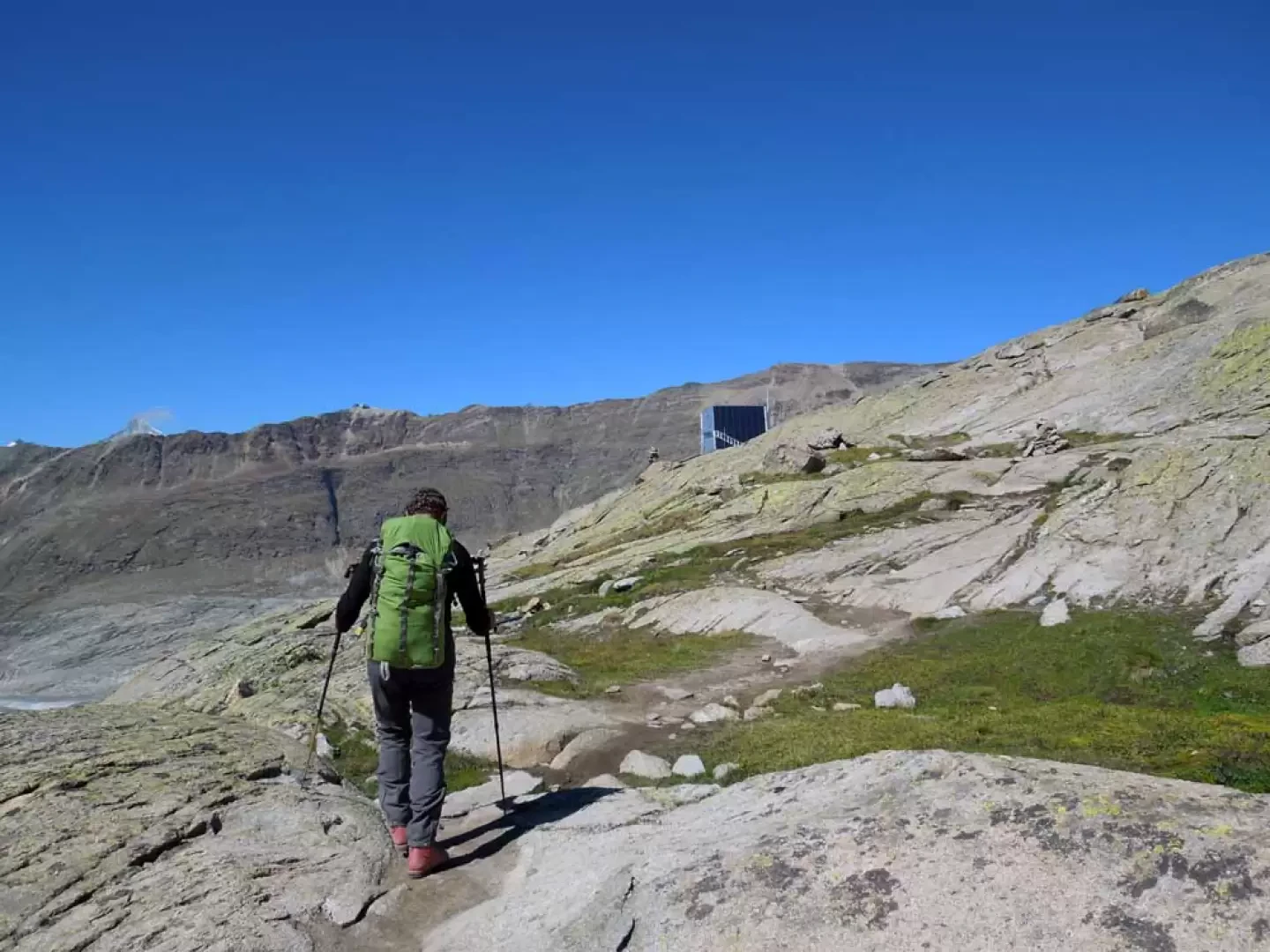
The new Monterosahutte hut was built about a hundred metres above the previous one and is a modern, high-tech building with a façade completely covered with solar panels; it is situated on a wide moraine ridge in a position from which one enjoys a truly exceptional panorama over the crown of 4000 m peaks that surround Zermatt, somewhat closed only to the east by the Gornergrat ridge. Reaching it involves the passage of some exposed equipped sections and the crossing of an up and down section of a glacier with some somewhat delicate passages between crevasses. The difficulties can therefore vary depending on the time of year and on the condition of the glacier and the equipped sections, which, assessed at the time, must be approached with care by hikers accustomed to progression on these types of terrain. Description From the railway station, walk towards the wide col below, crossing another path and passing by the markers on the obvious route, where you continue downhill. At the col, turn left and take a wide but exposed path, which at first level and then slightly downhill, begins a long route that cuts across the steep slope below the Gornergrat. After losing about a hundred metres in altitude, ignore a track that branches off to the left and arrive at a fork signposted (2,708m), where you continue straight on. You lose altitude again, heading towards the left (orographic right) tongue of the Gornergletscher and, having passed a marker, you leave the start of the old path behind and begin a section on rougher terrain, with which you reach some metal ladders. Having reached their base, cross a small metal bridge and reach the smooth rocks at the foot of the glacier, from where you follow the blue-white sticks that will guide you across the glacier. Once you have passed these rocks, with an almost level path, you descend decisively on a steep track with a few handrails at the most exposed points, thus reaching the glacier proper. From here, descend slightly, keeping to the left, then making a wide semicircle that takes us to a strip of the glacier covered by broken rocks from which we descend again to take the lower part of the central tongue of the Gornergletscher. On this section, we cross a somewhat crevassed area with the path, still indicated by the sticks, becoming more delicate to cross due to the numerous holes; we then turn slightly to the left, heading for a high rocky bastion, leaving the glacier at an altitude of around 2548 m where we take the track that climbs up towards the right on an oblique ledge with a handrail. Walking on slightly sloping slabs alternating with stretches of scree, you reach the base of some iron steps that go over a smooth slab that is a little more vertical, after which you turn left and cross a strip of smooth rock with the help of a handrail; at its end, you turn right and cross another steep section with the help of some wooden steps, just above which you arrive at the edge of a moraine that you follow to the right. Having passed below the now clearly visible vertical of the hut, the path turns decisively to the left and, with a slightly sloping section, soon reaches the gleaming construction. The inserted track continues from the hut on the normal to the Nordend to an altitude of 4133 mPhoto gallery


Comments (0)
Sign in to leave a comment