Ponale Road


Edited by:
Maurizio Loconti
Updated at: 03/11/2025
Access
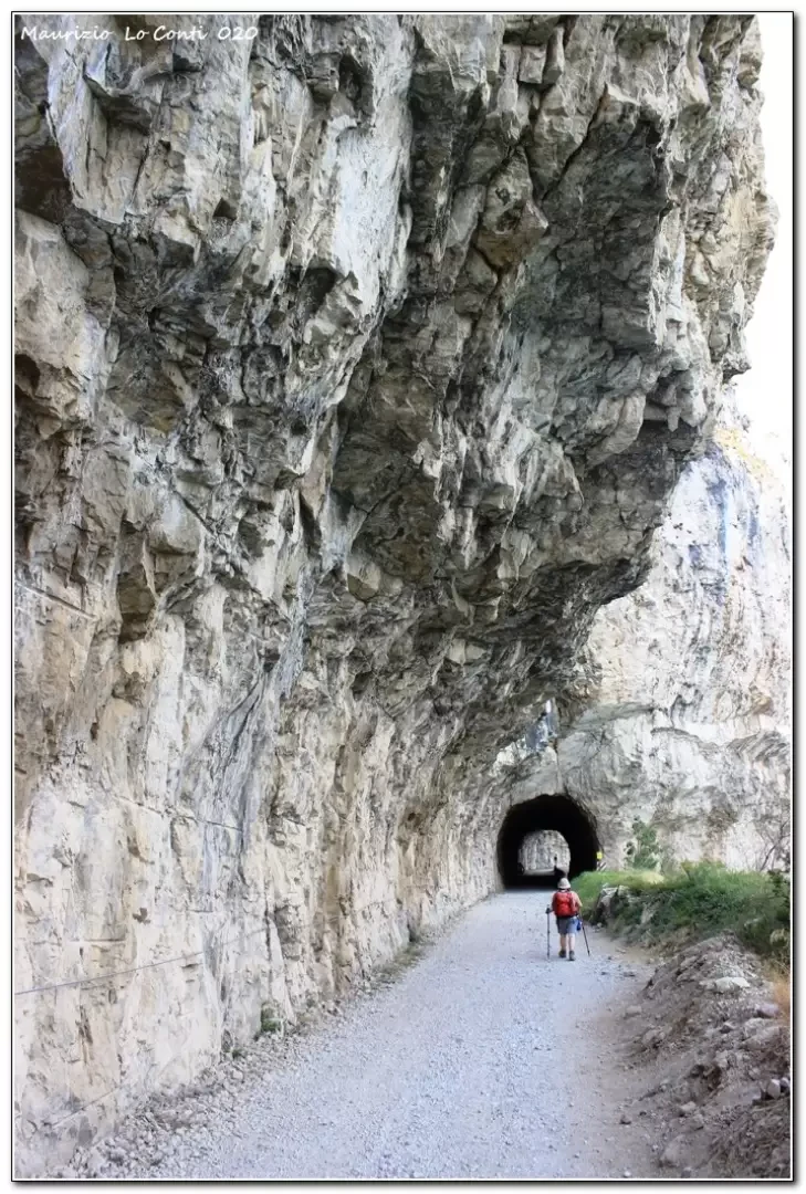
From Riva del Garda we drive back up to the Ledro valley, leaving the car after the long tunnels, before arriving at the village of Biacesa (free, 2020).
Introduction
Description
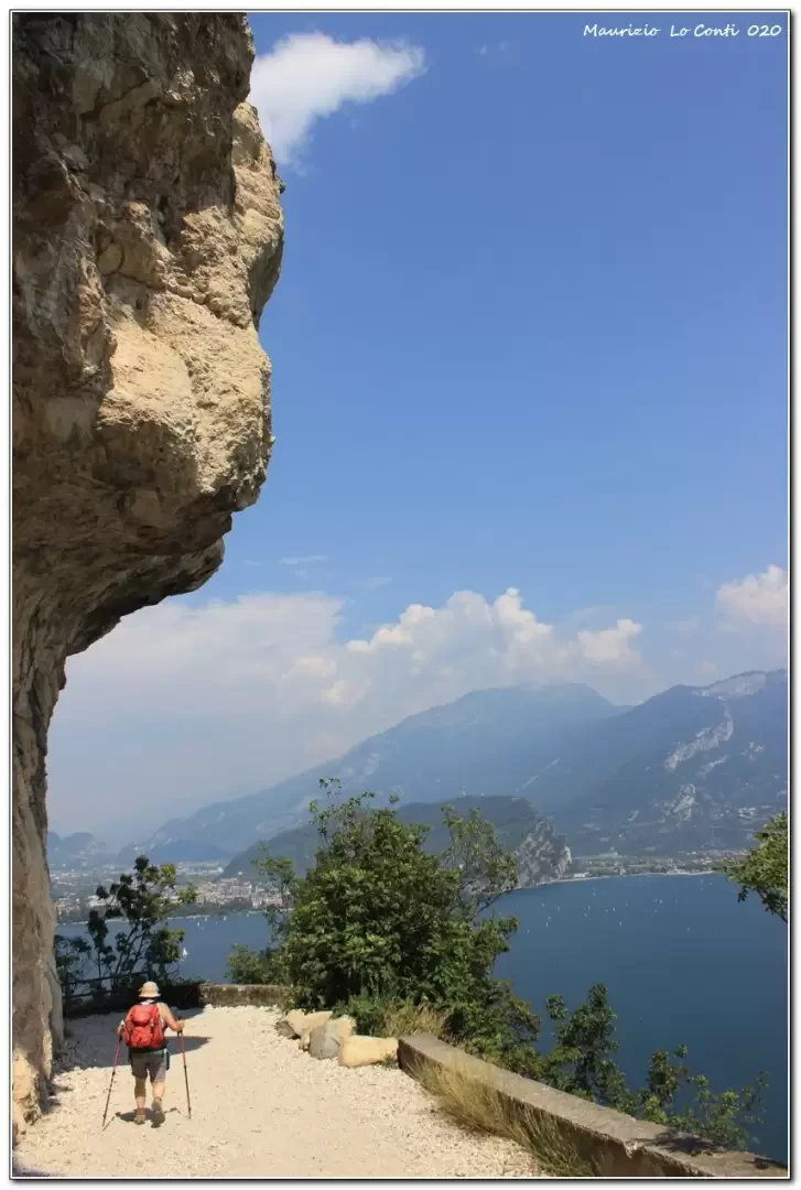
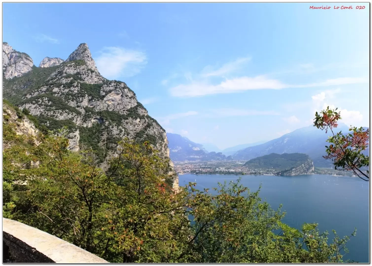
At first, on foot, one goes towards Pregasina; then one soon leaves the asphalt, losing altitude. Along the way one begins to read some posters telling the history of the place. You then cross the main Ponale road: to the left is the return, but, for the moment, you proceed to the right, paying attention to your bikes. It climbs with a series of hairpin bends. Beautiful views of Lake Garda. You reach the stature of the Regina Mundi, crossing the SP 234. The vantage point is remarkable and if you wish, you can already decide to turn back. Instead, you choose to continue on to Pregasina, where you take a break for lunch: you can eat at the shaded benches near the church (fresh spring nearby) or at one of the refreshment points in the village (tot. 1h30).
After the break, you turn back, passing by the statue and the morning crossroads; now you continue downhill on the most interesting part of the route. The road has literally been ripped out of the mountain and is all overlooking the large body of water! Finally, you arrive in Riva del Garda, where there is a beautiful old town centre. We zigzag as we please and, keeping in mind the bus timetable (line B214, one every hour on weekdays - summer 2020 - free with the Trentino guest card), we move on to the bus stop (V.le dei Tigli 21) where we take the bus (be careful not to get the wrong way round...) which takes us back to the car in a few minutes...
In summary: a fair day, a little hot, difference in altitude +300 m -600 m Dif. T for about 3h15 Tot . 13 km + all the breaks to see the various sights. Average ride comfort: excellent
If you want, here is the pdf photo file, with a bit more news:
http://cralgalliera.altervista.org/VacEst/VacEst020C.pdf
http://www.cralgalliera.altervista.org/altre2020.htm
http://www.cralgalliera.altervista.org/altre2021.htm
NB: In the case of an excursion, always check with FIE, Cai, any park authorities or other institutions, pro loco, etc, that there have been no changes that have increased the difficulties! No liability is accepted. This text is purely indicative and not exhaustive.
Info Hiking Section Cral Galliera: http://www.cralgalliera.altervista.org/esc.htm
trips 2021 at the link: http://www.cralgalliera.altervista.org/gite021.pdf
Photo gallery
Comments (0)
Sign in to leave a comment