Ancona
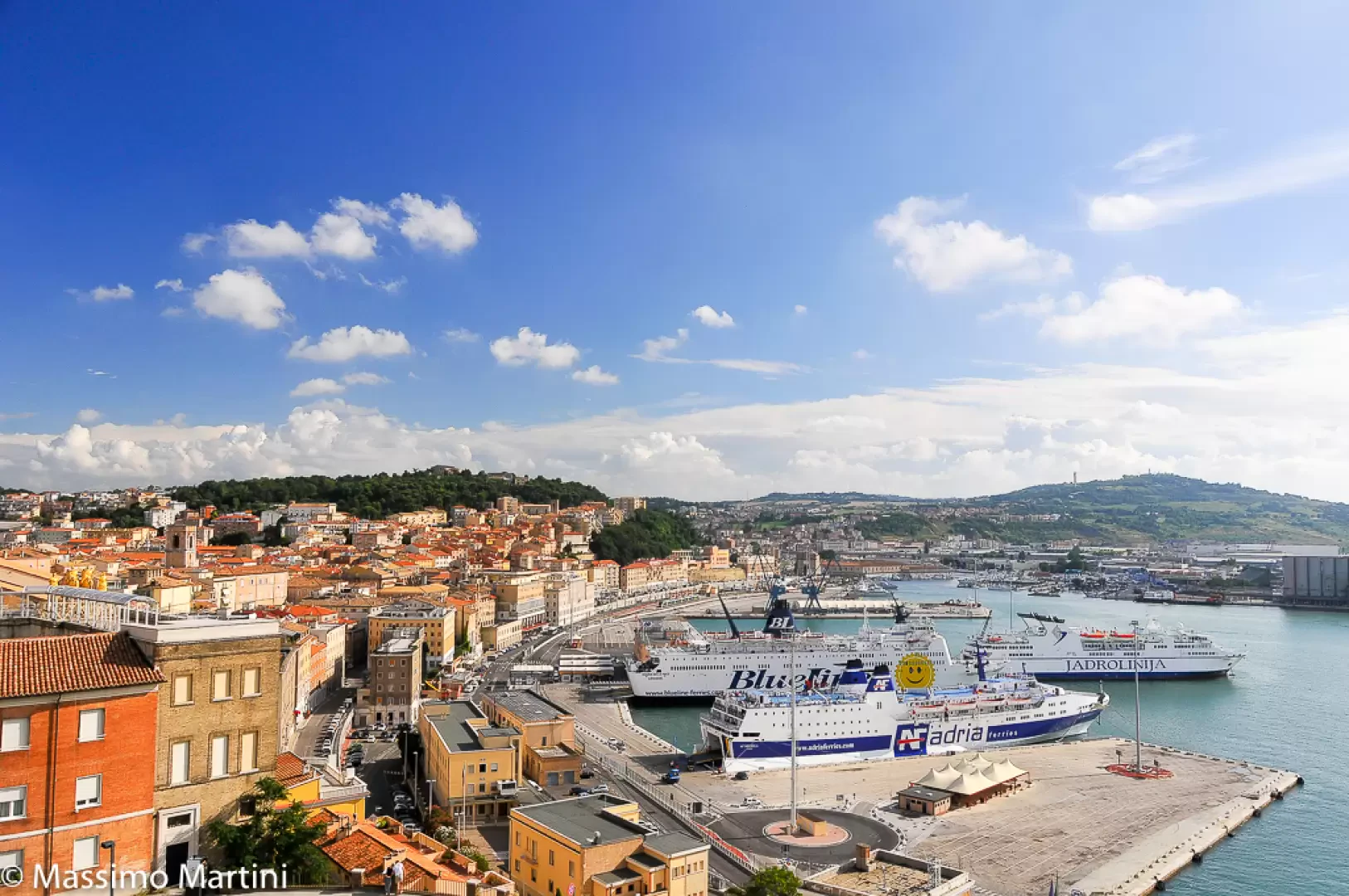 Photo by
Massimo Martini ©2014

Edited by:
Massimo Martini
Access
The town can be reached via the Bologna–Taranto motorway via the Ancona Nord and Ancona Sud junctions. The Adriatica state road runs along the coast northwards towards Senigallia and southwards towards Civitanova Marche, whilst the Val d’Esino connects the Ancona area with the Vallesina and Fabriano; branching off from the national road network are the provincial roads serving the inland towns and the Conero Riviera. Ancona railway station is a junction on the Bologna–Lecce Adriatic Line and the terminus for services to Rome along the Orte–Falconara line, served by Trenitalia’s (TI) regional, Intercity and Frecce services. The port is connected by ferry services to Croatia, Greece and Albania. The nearest airport with scheduled flights is the “Aeroporto delle Marche Raffaello Sanzio” in Falconara Marittima, which is connected to the city by public transport. Local public transport is operated by Conerobus S.p.A., with urban and suburban routes serving the outlying villages and the Conero Riviera. There are no seasonal restrictions on the ordinary road network.
Introduction
Ancona is the capital of the Marche region and of the province of the same name, situated on the central Adriatic coast, on the northern foothills of the Monte Conero promontory. The municipal area is set amongst a system of hills sloping down towards the sea, with the historic centre situated on Guasco Hill, which forms the northern tip of the promontory and overlooks the natural harbour. The shape of the coastline, which bends like an elbow towards the Adriatic, is the origin of the place name: the Greek name Ankón literally means ‘elbow’ or ‘angle’. The municipality borders Falconara Marittima, Camerata Picena, Agugliano, Polverigi, Offagna and Osimo to the north and west, and Camerano and Sirolo to the south; these municipalities share the Conero Regional Park area with Ancona.
Description
The municipal area occupies the northern tip of the Conero promontory, a limestone outcrop that rises to its highest point on the southern edge of the municipality, towards Sirolo. To the west, the promontory encloses the gulf into which the harbour opens; to the east, the coastline is high and cliff-faced as far as Portonovo Bay, where ancient landslides have formed a coastal plain with two brackish lakes, Lago Grande and Lago Profondo, which serve as a resting place for migratory birds. The orientation of the promontory means that both the sunrise and the sunset over the sea can be observed from the town. The hinterland consists of clayey hills furrowed by valleys that descend towards theAdriatic Sea; amongst these, the Pietralacroce valleys descend from the town towards the edge of the southern cliffs. The nature of the terrain makes the northern slope of the town prone to landslides, including the major landslide of 1982 in the Posatora district.
The earliest evidence of human presence dates back to the Lower Palaeolithic, with flint artefacts discovered on the summit of Monte Conero. The harbour was frequented by Greek sailors before the colony was founded, serving as a Greek-Picene maritime trading centre. In 387 BC, Dorian colonists from Syracuse founded Ankón, from which the city’s name and the epithet ‘Dorian’ are derived. In Roman times, Ancona became a municipium and then a colony, with a port of great importance for Adriatic trade: theArch of Trajan, erected in the 2nd century AD on the quays and built of Proconnesian marble, bears witness to the imperial influence on the port. In the Middle Ages, the city was a free commune and a maritime republic, until its annexation to the Papal States in 1532. The medieval heritage includes the Cathedral of San Ciriaco, of Romanesque design with Byzantine elements, atop Guasco Hill; the church of Santa Maria della Piazza; and, in Portonovo, the church of Santa Maria, an 11th-century Benedictine abbey. The works of the Dalmatian architect and sculptor Giorgio da Sebenico date from the 15th century, including the portals of San Francesco alle Scale and the former church of Sant’Agostino, as well as the façade of the Loggia dei Mercanti; the 18th-century Mole Vanvitelliana, a pentagonal lazaretto built on an artificial island in the harbour. During the 20th century, the bombings of the Second World War and the 1972 earthquake caused significant losses in terms of built heritage and population.
The city’s economy is linked to the port, one of the main Adriatic ports for international passenger traffic, alongside shipbuilding, logistics and fishing. Since ancient times, the white stone used in the cathedral and the church of Portonovo has been quarried from the Conero quarries. On the southern hills, extra virgin olive oil and wines with protected designation of origin (PDO) are produced, including Rosso Conero PDO and Conero PDO; in Portonovo Bay, wild mussels – a Slow Food Presidium – are harvested.
A substantial part of the southern municipal area falls within the Conero Regional Park, established in 1987 across approximately 6,000 hectares spanning the municipalities of Ancona, Camerano, Sirolo and Numana. The vegetation is dominated by Mediterranean scrub featuring holm oak (Quercus ilex), strawberry tree (Arbutus unedo), mastic (Pistacia lentiscus) and laurotino (Viburnum tinus); the name ‘Conero’ is thought to derive from the Greek word ‘Kómaros’, meaning ‘arbutus’. On the coastal cliffs grow the red juniper (Juniperus oxycedrus), thetree spurge (Euphorbia dendroides) and the Rhine reed (Arundo pliniana). The Aleppo pine (Pinus halepensis) originates from reforestation efforts in the early decades of the 20th century.
The Conero Park’s network of walking trails extends both along the sea-facing slope – which is steep and has exposed sections – and along the inland slope, with more gentle gradients, and connects the town with Portonovo and the upper part of the promontory. Some of the beaches on the Conero Riviera within the municipal area, such as Portonovo, Mezzavalle and Vela Beach, can be reached on foot via footpaths and narrow tracks.
Information
General information
Area: 125.13 km²
Altitude of the county town: 16 m
Highest point: 572 m – Mount Conero
Population: 100,151 (as at 1 January 2026)
Name of inhabitants: Anconetani
Patron saint: Saint Cyriacus, celebrated on 4 May
Neighbouring municipalities: Agugliano – Camerano – Camerata Picena – Falconara Marittima – Offagna – Osimo – Polverigi – Sirolo
Province: Province of Ancona
Region: Marche
Country: Italy
Official website: comune.ancona.gov.it