Lake Luseney, from the car park at Porliod

Edited by:
Massimo Martini
Updated at: 14/08/2026
Access
Road directions
Leave the motorway junction at Nus and drive through the first roundabout, taking the first exit towards Fénis. After 600m (0.6km), approach the second roundabout, take the third exit and continue on the for 900m (1.6km). Turn right onto Via Champagne and, after 70m, turn right again onto the ; after 160m (1.8km), turn left onto Via Saint-Barthélemy/ and begin the climb towards the upper valley. Follow the for 16.0 km (17.8 km), passing through the villages of Petit-Fénis and Blavy, until you reach the square in Lignan. Turn right and, after 180m (18.0km), turn left; continue for 800m (18.8km) and keep left through the villages of Saquignod, Vénoz and Crét for 2.8km (21.6km) until you reach the Porliod car park.
Car park
At the top of the climb is the free 🅿️ Porliod car park, situated in front of the picnic area of the same name. The car park has no known seasonal restrictions; caution is advised in the event of snow or ice during the winter months.
Access by public transport
To reach the starting point of the route, you will need a private vehicle, as the area is not served by public transport.
Distance and walking time
🕒 walking time: 34 minutes
📏 distance: 21.6 km
GPS navigation
Important information
The directions provided were verified on the date the route was mapped. Before setting off, we recommend checking for any changes to the route or road conditions. For up-to-date information, please consult Google Maps or Apple Maps.
Introduction
A round-trip route that follows the entire length of the Saint-Barthélemy valley, from Porliod to its end point at the foot of Becca Luseney.
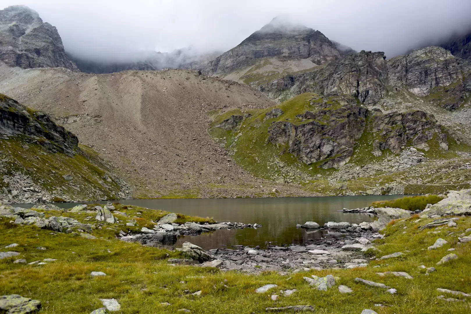
The route passes through, in succession, the typical landscapes of theupper valley: once past the chapel of Saint-Pantaléon, just above Porliod, the track enters a larch forest and then a fir forest, passing through the mountain pastures of Larset Dèsot, Nouva, Champcombre and Vallorsière. Beyond the Champlaisant crag, the track reaches the Magià Mountain Hut, a halfway point, before continuing through the pastures of Ollière and Praterier. Once past the ruins of the Les Crottes mountain pasture, the route joins the Alta Via 1 trail and climbs via a series of hairpin bends to the Luca Reboulaz Bivouac. From here, following the signs for Alta Via 1 for a short distance, you reach Lake Luseney in a few minutes: walking partly along its shores offers the most picturesque views for photography.
The recommended time of year is early summer, when patches of residual snow in the higher valleys are set against the colours of the thaw. For most of the route, the path follows an easy farm track; only on the final stretch, beyond the mountain pastures of Les Crottes, does the terrain become more uneven, with scree and steeper hairpin bends leading up to the bivouac. Overall, it is a long rather than technically demanding hike, suitable for those seeking a continuous traverse through the high-altitude environment of the Saint-Barthélemy valley.
Description
0h00' 0.00km 105km From the car park, head down the path until you reach the village of Porliod (1,882m). After a short climb, you’ll reach the chapel dedicated to Saint-Pantaléon, near which the tarmac road ends. Continue on a gentle climb along the dirt track, which leads into a small larch forest (Larix decidua). Cross the catchment area of the Torrent de Chavalary and, once you have crossed the stream, reach the Larset Dèsot mountain pasture (1,893 m). A little further on, you’ll come to a signpost and the junction for Praz 105km.
0h20' 1.54km Continue along the dirt track, following the undulating contour of the slope, which continues with a gentle ascent, leading to the group of houses at Nouva (1,955 m). From here, the narrow track levels out before descending gently towards the picturesque clearing of Champcombre (1,932m), where there is a mountain pasture and a few huts.
0h30' 3.05km At the junction, keep left and continue along the dirt track, which is now level, as it curves widely to the right, entering the upper part of the Saint-Barthélemy Valley. The route enters a picturesque fir forest and, once past the Vallorsière mountain pastures (located below the road), you reach the Champlaisant crag. A little further on, on the right, a small track branches off leading to the mountain pastures of the same name (1,900 m).
1h20' 5.08km (101 m ascent) (51 m descent) Stay on the main road, ignoring the small track that descends towards Champlaisant, as the picturesque pastures begin to come into view. After a few minutes, you’ll reach a characteristic aqueduct. Cross the Torrent de Saint-Barthélemy via a small concrete bridge, situated near the Les Vayoux mountain pastures. From here, head to the left-hand side of the valley and, in a few minutes, you’ll reach the Magià Mountain Hut (2,007m).
1h50' 7.10km After a few hundred metres, you’ll skirt the Ollière mountain pasture (2,013m), near which the path to Cima Bianca begins.
1h55' 7.10km Continue, leaving the Praterier mountain pastures (2,060 m) to your right, and leave the easy track for the path that begins to climb the final stretch of the valley. You cross an initial, fairly flat stretch amongst a few scattered larch trees (Larix decidua) before beginning to climb the final section of the valley, which culminates at Becca des Crottes, on its orographic left-hand side amongst pastures and scree. Once past a scree slope with whitish debris, the path begins its final ascent; ignore a small path on the right and you’ll reach the ruins of the Les Crottes mountain pastures (2,389 m).
2h30' 9.81km (575 m ascent) (88 m descent) Shortly after the mountain pastures, you come to the Alta Via 1 route: continue by turning left to climb a hillock, on top of which the bivouac is situated. The path follows the outflow from Lake Luseney and, via a series of hairpin bends, climbs approximately 200 metres in altitude. Once the ascent is complete, you cross a plateau and finally reach the Luca Reboulaz Bivouac (2,574 m, 3h00').
3h00' 10.62km (789 m ascent) (118 m descent) From here, briefly follow the signposts for the Alta Via 1 trail and reach Lake Luseney after a few minutes; you can walk along a section of the shore to find the most picturesque spot for a souvenir photograph. Lake Luseney (2,576 m)3h10' 10.98km (802 m elevation gain) (122 m elevation loss)
The return journey follows the same route as the outward leg, retracing the farm track until you reach Champcombre, Porliod and the car park, the starting point of the route (1,889 m) 2h30' 10.97km .
Places of Interest
Porliod picnic area
Comments (0)
Sign in to leave a comment