The Via del Bitto, from Morbegno


Edited by:
Marco Bonati
Updated at: 22/09/2024
Introduction
The short trek retraces the traces of the ancient seasonal transhumance routes that led the herds from the bottom of the Valtellina valley to the maggenghi and high-altitude pastures straddling the Valgerola (SO) and Valvarrone (LC). To this day, the milk, milked locally by hand, is used to produce the prized Bitto cheese: just a few wheels a day for a few weeks a year. Already sold before being produced! The path, as far as Gerola Alta, only retains its original appearance and structure in a few sections, but manages to follow a route - despite the obligatory short distance from the provincial road - that is isolated and sufficiently representative of the original environment. The area of the high pastures has been subjected to heavy hydroelectric exploitation, but the numerous artificial lakes are now part of the landscape. There are also traces of active mining excavations from Roman times to the late Middle Ages and ruins of the military structures of the Cadorna Line. The route can be comfortably covered in 2 -3 days (return by bus) or with three separate hikes (two walks of difficulty T and one hike EE): in the description, ring routes are highlighted - when possible - for individual hikes.
Description
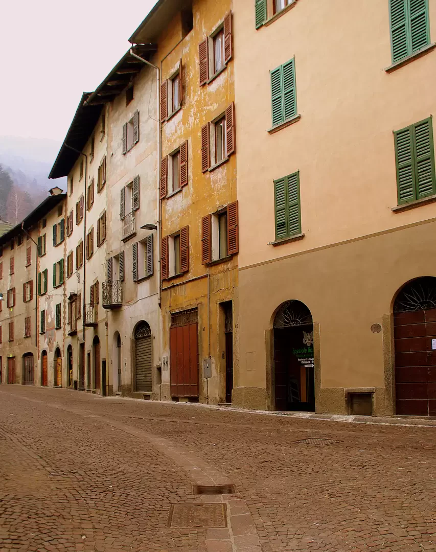
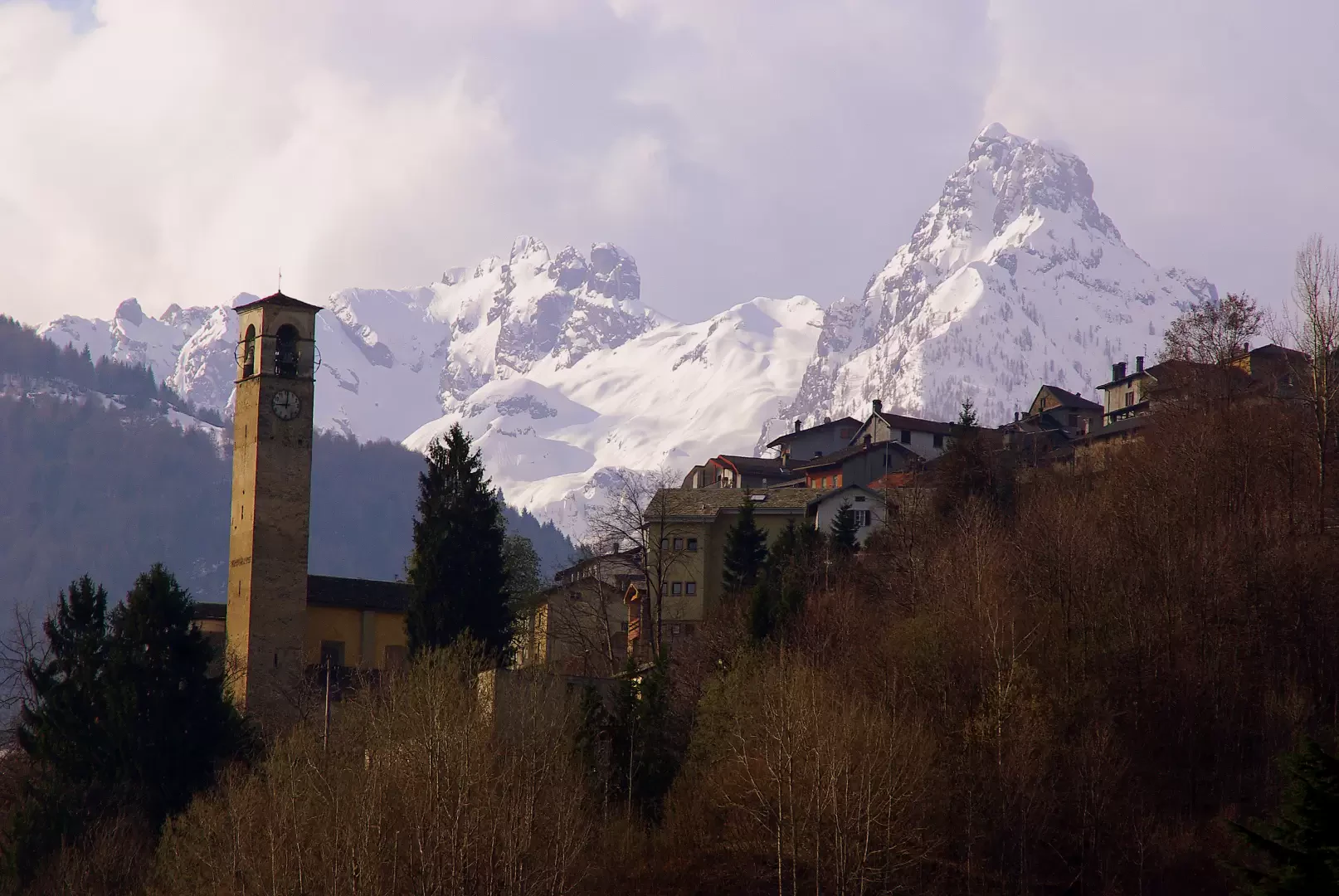
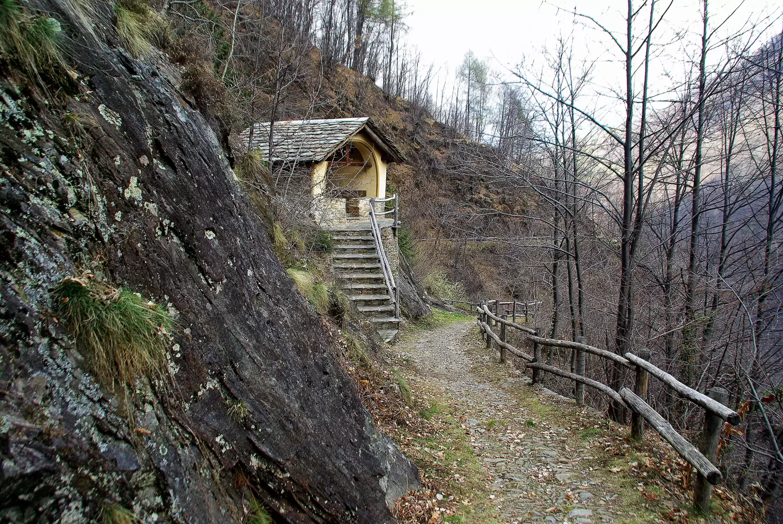
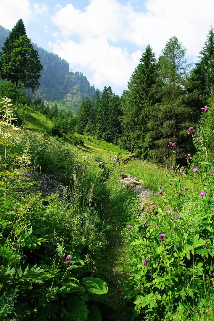
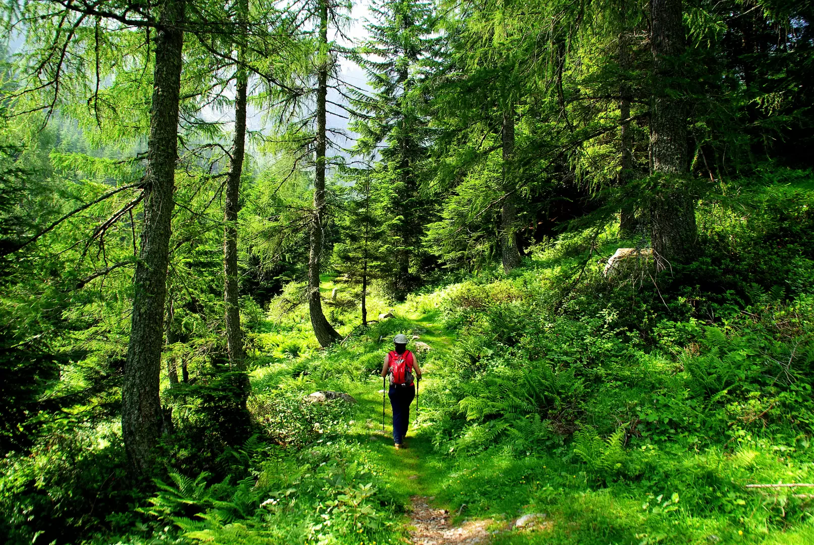
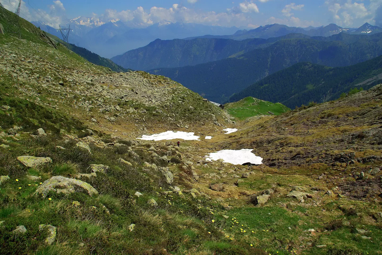
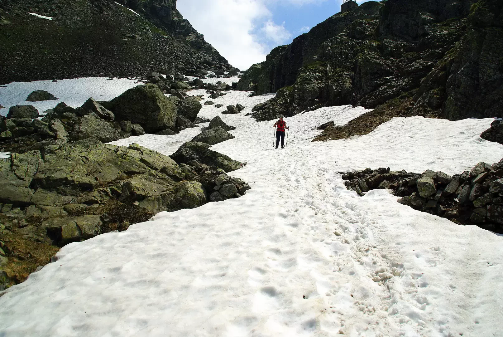
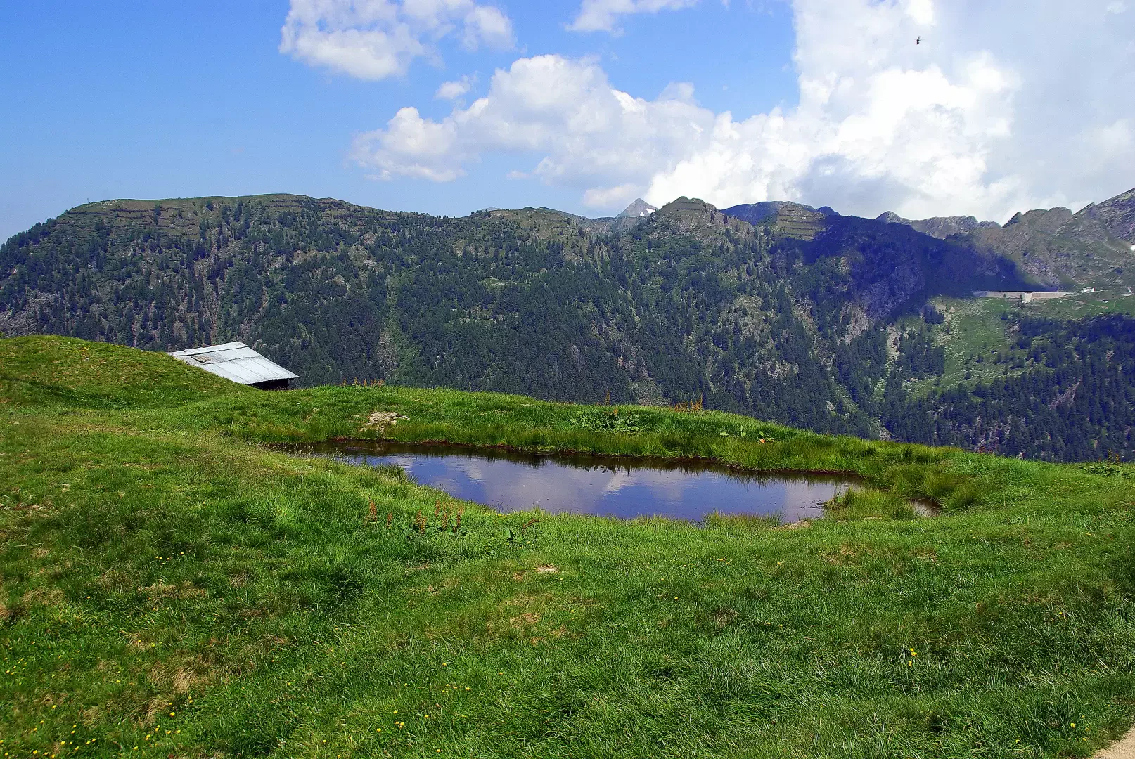
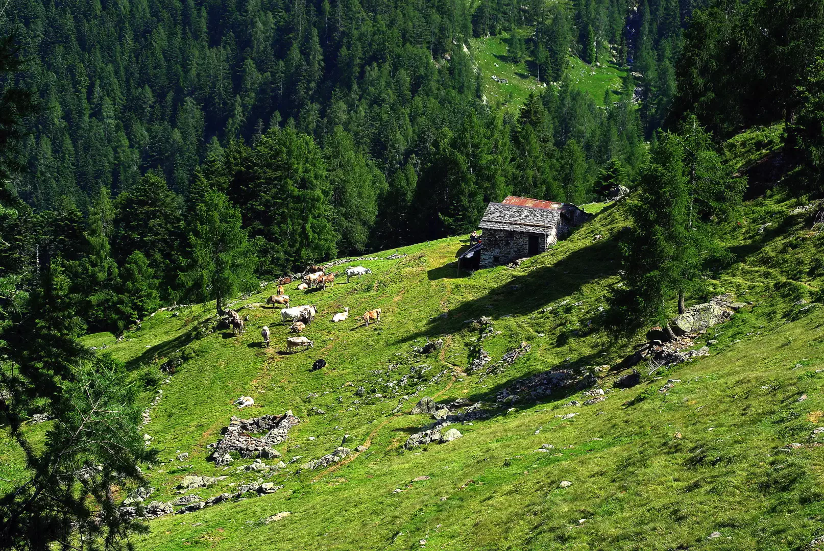
From the Morbegno 244 m railway station, walk the entire length of the avenue in front (Viale Ambrosetti) to the characteristic crossroads of Piazza III Novembre (in front, a famous shop selling various kinds of goods and, typically, Bitto cheese); pass on the right into Via Pretorio (the Magistrate's Court building) and cross the Bitto river into Via Cotta (near the small but well-made Civic Museum of Natural Science). Between the houses on the left-hand side of Via Cotta is the narrow Vicolo Nani (signs, also vintage), which is the beginning of the old road to Valgerola. Passing under a portico, the ascent begins immediately: initially a steep grassy flight of steps between the walls of vegetable gardens and gardens, which soon merges into a more modern path that winds its way up the wooded slope. The ruins of an old church (long since undergoing very slow restoration) and a sort of rustic inn precede the Campione 580 m basin with its huts and scattered cottages. A few more hairpin bends and you cross the provincial road to Valgerola: on the other side, the track continues straight for a few hundred metres until reaching Sacco 700 m, a hamlet of Cosio Valtellino. A visit to the village and its Homo Selvadego Museum is highly recommended. [A possible excursion limited to Sacco can include a return with a partially circular route. Back in Campione, you will see a sign on the left for "Regoledo di Cosio": this is a splendid old cobbled mule track enclosed by dry stone walls ("risc"). You reach the bottom of the valley in the hamlet of Cosio adjacent to Morbegno: following the small streets of the village in an easterly direction, you arrive without any possibility of error at the starting point near the Bitto river. Difficulty in ascent T; for the descent variant E; complete tour 3 hours 30 minutes]. The second part of the trek takes place on a parallel and lower route than the provincial road. Only a short section carved into the rock at Val di Pai is original: the rest has been continually modernised for extensive use. Next to the Albergo S.Marco a small road, at first asphalted, branches off from the provincial road and leads to Rasura 762 m. Noteworthy along the way is the presence of the Mulino del Dosso (Dosso Mill), currently the headquarters of the small "Vanseraf" Ethnographic Museum ( http://www.museovanseraf.com/index.html ). Surrounded by the cemetery walls, continue along the hillside until crossing the Val Mala gorge on a beautiful bridge: in a dominant position, a chapel known for its ex-votos ("Gisoeul del Pich") 906 m. After crossing the dirt road down to a hydroelectric power station, we arrive at the few restored huts in Valcornale. Here, our road loses its way in a landslide and, to reach - in short - Pedesina 991 m, it is necessary to walk along a section of the provincial road. We find the path again just beyond the village, on the left at a notice board indicating 'work in progress'. The trail is just a very steep little path that descends in narrow bends to the bottom of the Val di Pai (very old steps carved into the rock and a modern lamellar wooden bridge). One climbs the other side (Danger!) over landslide-prone, uneven, wet and prone to falling stones. A dense reforestation forest precedes the meadows of the Valle district 998 m. We reach Gerola Alta 1053 m along the provincial road. [Single hike A/R. Difficulty T with a short EE section; time 2 hours 30 min.]. From Gerola Alta, one enters the territory of forests and pastures, where herds of dairy cattle (until now in seasonal transit: "cargamunt" and "scargamunt") devote themselves to their prized milk production. Just beyond the village, at the valley station of the ENEL cable car, the Valle della Pietra trail begins: with little gradient as far as the bridge, on the other side it starts with a series of hairpin bends through the larch forest, ending on the Trona Soliva meadows. Along the way we come across a signposted fork with the same destination: Rifugio Trona; the path to the right - ours - is the traditional shepherd's path, the other is more recent and linked to the construction of numerous hydroelectric plants. On the level, we reach the Casera di Trona Soliva 1907 m: a building that is half casera and half Rifugio Trona. The path, with little slope, goes around a marshy little valley, then leading to the base of the short gully adducing the Bocchetta di Trona 2092 m. On reaching the pass, the panorama opens out onto the pastures at the head of the Valvarrone valley dominated by the peak of Pizzo Varrone. This is where the Bitto cheese production area ends, and possible continuations - not on the transhumance trail - are numerous on the high pastures in the direction of Premana (LC) or Valsassina (LC). [Wanting to return to Gerola Alta along a circular route, it is possible to continue with this beautiful excursion. From the Bocchetta (ruins of the Cadorna Line), take a small path on the left that leads to the FALC hut 2126 m at Bocchetta di Varrone: it is a ledge path, with some ups and downs, in the more exposed sections assisted by handrail cables. From the hollow of the hut, descend on a nice path to the dam of Lago d'Inferno 2085 m; continue - written in paint on the stones - in the direction of "direttissima Pescegallo": the path, narrow, steep and stony, descends rapidly to the dam of Lago di Trona 1805 m, passing above the remains of ancient iron ore mines. A short ascent through the sparse larch forest leads to a wide, level track that skirts the Pizzo del Mezzodì at altitude up to a grassy shoulder with a small hut and watering hole 1835 m. The track, which is not very visible, descends alongside the building into the meadows on the line of maximum slope: when you arrive in the forest, you find yourself on a beautiful path. With a constant slope, in hairpin bends, you reach the small Maggengo della Casera 1580 m; beyond a second strip of woodland, you reach a forest track near the hamlet of Fenile 1238 m. Without crossing the Bitto river, continue downstream between the small villas following a dirt road that, before entering the fir forest, turns into a forest track: a few metres and, near some dry stone walls, you will find a steep and uneven path that leads back to a new track right near the ENEL cable car valley station. Difficulty EE; time 6 hours 30 min]. A return trip to Morbegno can be made comfortably by bus.
.Galleria fotografica