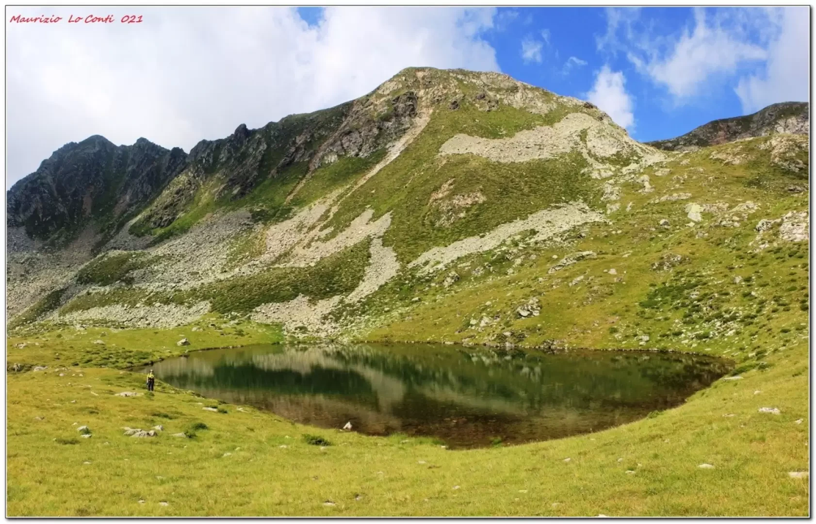
Lake Cemiglio, from Pont dal Vat


Edited by:
Maurizio Loconti
Updated at: 03/11/2025
Access
Thanks to the managers of the refuge, the journey from 'Pont dal Vat' 1256 m (above Rumo, hamlet of Lanza - Val di Non), which is too steep for normal cars (check for bans), is possible with their vehicle up to the refreshment hut (1925 m); otherwise it takes about 3h15 more on foot, round trip.
Introduction
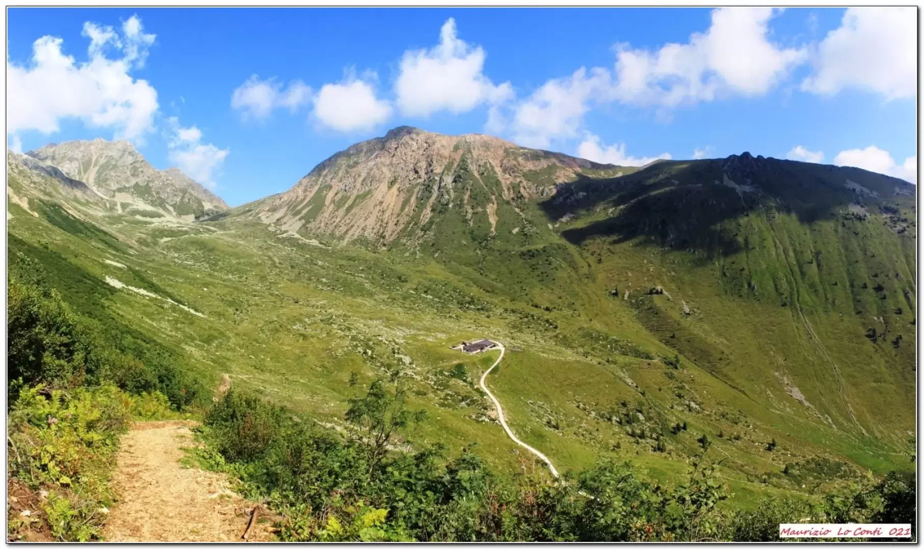
The high mountain setting in the Maddalene hut area is very beautiful! It repays the efforts made, despite the little height difference.
Description
0h00' With the poles it is easy to get your bearings (to the right, behind the refuge). After an easy first section, there is a non-trivial piece. At a fork, keep to the right. You cut very steep slopes on a narrow and barely noticeable track (being downhill, this is more complicated... on the return, uphill, it is better). This involves a much slower than usual walk, with several ups and downs... Finally, you find the junction with the main route and the situation improves. You get up, steeply, brushing against some ruins. The first puddle is touched, but... beware... it is not the lake... which is located just above it, a few minutes away (2269 m - 2h05); a stop is a must...
The return journey takes 1h40 on the same route. The meal from the Maddalene refuge is excellent!
In summary: a discrete day's descent of 400m Dif. E (of medium-high level) 7km x about 3h45 Tot. (2h05 and 1h40 ret.) + all the breaks to see the various places you encounter. Average level of difficulty: in places poor
If you wish, here is the photo pdf file, with a little more information:
http://cralgalliera.altervista.org/VacEst021E.pdf
http://www.cralgalliera.altervista.org/anno2021.htm
http://www.cralgalliera.altervista.org/altre2021.htm
NB: in the event of an excursion, always check with FIE, Cai, any park authorities or other institutions, pro loco, etc., that there have been no changes that have increased the difficulty! No liability is accepted. The present text is purely indicative and not exhaustive.
Info Hiking Section Cral Galliera: http://www.cralgalliera.altervista.org/esc.htm
Trips 2021 at link: http://www.cralgalliera.altervista.org/gite021.pdf
General information
Signpost: SAT
Type of route: a/r
Recommended period: June, July, August, September,
Sun exposure: east
Objective Danger: very careful, if wet
Exposed Sections: long section with very steep slopes
Photo gallery
Comments (0)
Sign in to leave a comment