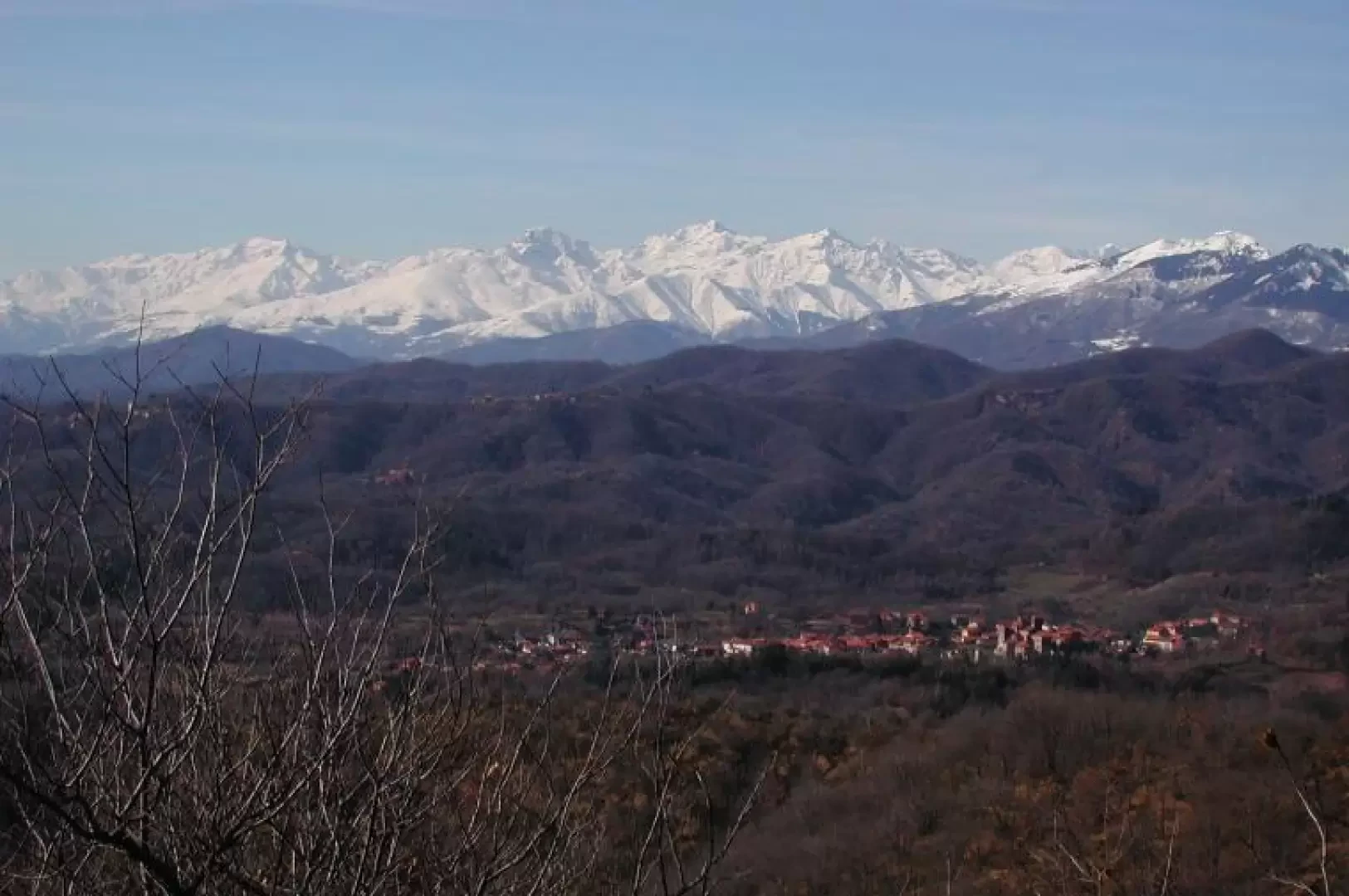
Among the vineyards of Bramaterra

Introduction
The whole area is characterised by almost parallel hills and ridges that start from a chain bordered to the north by the Valsessera and reach as far as the plain. It is interesting to note the geological origin of this area, which is much older than the rest of the Biellese: it is what remains of a mountain chain that rose 250 to 300 million years ago. I quote from the 1998 newsletter published by the CASB (Consociazione Amici dei Sentieri del Biellese) "In the western part, up to the Rive Rosse di Curino, there are granitic rocks, in the eastern part volcanic rocks with a reddish colour like that of porphyry, the product of eruptions that occurred in the same period or shortly afterwards. Wedged in this structure, in the Sostegno valley, emerges the largest complex of carbonate rocks in the Biellese area, predominantly basic, contrasting with the surrounding acid rocks. To give an idea of the period of formation of other parts of the Biellese, the granite of the Cervo valley emerged from 30 million years ago, the Serra was formed in the last million years, the uplift of the Biellese Alps began 30 to 50 million years ago'. Atmospheric agents have worked the rocks over a long period of time, reducing them to sands moulded by runoff; the soil is therefore poor, and frequent outcrops of firmed sand can be seen among the shrubs, with yellow, ochre, red and purple colours that stand out among the green vegetation. In addition to these geological features, the area also has a history of its own. It was a border land with Valsesia, and from one of the small mouths we encounter on the route, the dead of Sostegno were transported to be buried at the Pieve di Naula. Along the route there are two unguarded bivouacs with tables and benches where you can enter to eat or rest.
Description
Leaving the car behind, head to the left of the church and take the tractor road. We are in the midst of vineyards, far around us, the Biellese Alps, particularly snow-covered this year, frame the hills, overlooked by Monte Barone di Coggiola. Continue along this road, ignoring the various detours to the right. After a while, on our right, there is a pretty little Romanesque church, with a remodelled bell tower, surrounded by vineyards. Our tratturo enters the woods, bare in February, but remains almost always on the ridge of the hills, allowing us a beautiful view both to the right, of the Biellese Alps, and to the left, of the Lombardy Pre-Alps. The route is partly that of the Gtb, Gran traversata Biellese, and also part of a much wider tour through the vineyards. For this reason, three wooden bivouacs have been set up, two of them in the section described here. We almost immediately encounter the first, but continue climbing effortlessly until we come to a diversion that climbs steeply in front of us, for about fifty metres, to the Frascheja peak (625m), with the second bivouac, and an exceptional view (about two and a half hours from the start). Before ascending, a small area has been set up with a parapet, in a spot free of vegetation, to admire the view and the small village of Sostegno, ahead of us. We descend back onto the tractor-track and continue with a series of slight ups and downs, until we cross path 704, under the Pietra Croana; this route starts near Sostegno and, as a panel explains, was the one taken with the dead to give them burial at the Pieve di Naula, a Romanesque abbey of very ancient origin (5th century A.D.), near Serravalle Sesia (from naola, a small boat used to cross the Sesia). This is also the starting point of the 700 trail that climbs to Pietra Croana (695m, 1h00' from the Frascheja), a rock gymnasium known to mountaineers from Serravalle, Varallo and the surrounding area. The path is well marked and climbs steeply in the forest, the last section very steep; from the summit, there is a beautiful view of the entrance to Valsesia and beyond. From the summit, path no. 700 descends to the left, at first quite gently and then sharply, for about 200 metres in height difference, partially bypassing the Croana; in February the ground was quite icy and slippery, and the terrain is very steep in places: there are only a few red marks on the trees at the beginning, then from a certain point onwards it is not marked, although it is well identifiable; if, however, you have children with you or you don't feel safe, forget it and retrace your steps to the starting point of the diversions.
After about twenty minutes we literally glide to Bocchetta di Ovasine (510m); from the Bocchetta, you could climb up the ridge to the Sant'Emiliano Sanctuary (another 200m in height difference) and from there descend to Sostegno. We decided to simply descend to Sostegno, via a nice tractor road, taking it to the left of the Bocchetta di Ovasine; the path is not special, damp and among the trees. In just over half an hour we are in Sostegno; at this point, we are on the tarmac road, descend to the bottom and then follow it to the left until we find a signpost on the other side of the road indicating the direction to Casa del Bosco, to recover the car. We cover the last 4km in about forty munits, again several ups and downs. We immediately pass a church, then through the vineyards, descend to a bridge that crosses a little stream, climb up again until we pass the cemetery, and after a short while we are back at the car.