Villeneuve

Edited by:
redazione
Access
Villeneuve can be reached from the motorway via the Aosta Est junction, continuing westwards along the state road through the Aosta ValleyAosta, which runs through the valley floor of the Dora Baltea and leads directly to the village. The provincial road connects the municipal centre to the hamlets and the side valleys of Rhêmes and Valsavarenche. The nearest rail service is at Aosta station, served by Trenitalia (TI) on the Turin–Aosta line; from Aosta, there are Arriva services to Villeneuve. The seasonal closure of access roads to the side valleys — in particular towards Rhêmes-Notre-Dame and Valsavarenche — should be checked on a year-by-year basis, as it depends on snow conditions.
Introduction
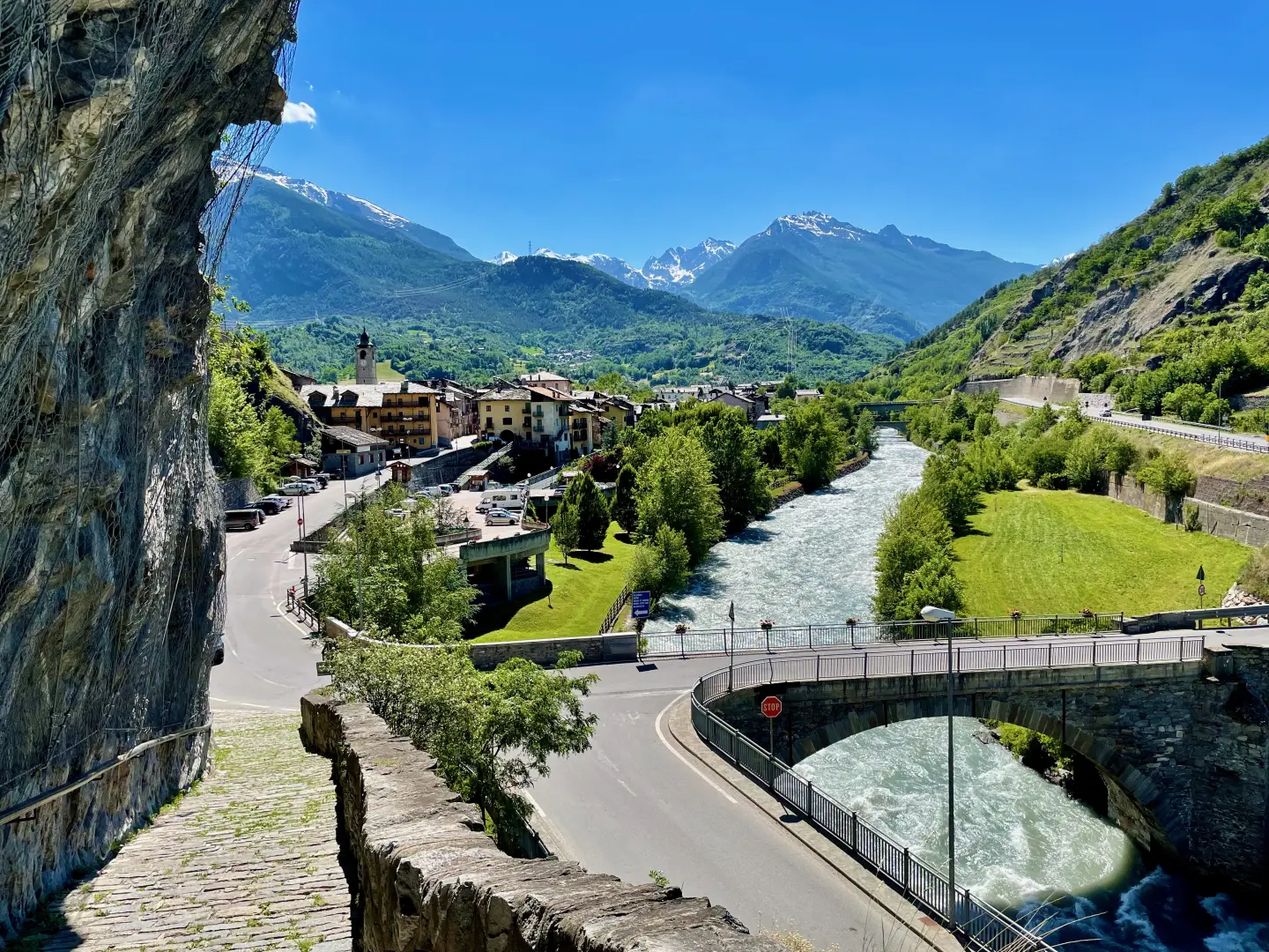
Villeneuve is situated in the middle Aosta Valley, at an altitude of 670 metres, along the valley floor of the Dora Baltea, a few kilometres west of the regional capital. The municipal area extends across both sides of the valley, from the floodplains at the valley floor up to the higher elevations towards the side valleys of Rhêmes and Valsavarenche – which provide access to the Gran Paradiso National Park – and borders the municipalities of Arvier, Aymavilles, Introd, Saint-Nicolas, Saint-Pierre and Valsavarenche. The name, which derives from the Latin expression villa nova, is common in the place-names of the Aosta Valley and reflects the frequent rebuilding of settlements in the valley floor, which were historically exposed to flooding from the Dora Baltea. Human presence in the area has been attested since at least the Eneolithic period, as evidenced by the funerary finds unearthed at the beginning of the 20th century. The municipality, however, owes its historical significance to the castle of Châtel-Argent, built in the 13th century on a rocky outcrop overlooking the entire plain, which for centuries was the centre of a feudal power that controlled the routes between the Little St Bernard Pass and Aosta.
Description
The Villeneuve area occupies a key position within the Aosta Valley’s valley system: the valley floor of the Dora Baltea reaches awidth that has historically allowed for stable agricultural settlement, whilst the northern and southern slopes rise steeply towards the ridges that separate the valley floor from the side valleys. The Dora Baltea flows with a distinctly torrential character, with stretches of rapids that characterise its course in this section. The valley floor alternates between floodplains and lowland farmland, with sunny vineyard slopes on the most favourable aspects.
The Eneolithic finds documented in 1917 during work on a hydroelectric power station — twenty-five graves containing grave goods — attest to human occupation of the site dating back over four thousand years. The most significant turning point in local history, however, occurred in the 13th century, with the construction of Châtel-Argent Castle on a spur rising from the northern edge of the valley floor. The fortress served as a centre of justice and control over Alpine transit routes, and had its own mint; the keep, which is still preserved, dominates the landscape as the town’s most recognisable architectural landmark. Between the end of the 18th century and the19th century, the decline of its military function and the growth of the manufacturing economy led to the opening of a foundry that processed iron extracted from the mines of Cogne, establishing an industrial activity in the municipality that was later phased out in the 20th century.
The modern economy is centred on dairy production, hillside viticulture and outdoor tourism, the latterthe latter being favoured by the rapid stretches of the Dora Baltea, which have made the municipality a hub for white-water activities — rafting, kayaking and hydrospeed.
To the west, the municipal area borders the Gran Paradiso National Park, of which the Rhêmes and Valsavarenche valleys form part.
The network of footpaths branching out from the main town and the hamlets provides access to the mountain pastures and the side valleys, with a range of hiking opportunities suited to both families and more experienced hikers heading for the heights of the Gran Paradiso.
Information
General information
Area: 8.80 km²
Altitude of the main town: 670 m
Highest point: 2,267 m – slopes of Becca Plana
Population: 1,284 as at 31 May 2026
Name in the local dialect: Veullanoua
Name of inhabitants: Villeneuvien or Villeneuvois or Veullatsou (-ouye)
Patron saint: Saint Blaise, celebrated on 3 February
Neighbouring municipalities: Arvier – Aymavilles – Introd – Saint-Nicolas – Saint-Pierre – Valsavarenche
Province: Aosta Valley (single administrative level, coincides with the Region)
Region: Aosta (single administrative level, coincides with the Region)
Region: Aosta (single administrative level, coincides with the Region)
RegionAosta (single administrative level, coincides with the Region)
Region: Valle d'Aosta
Country: Italy
Official website: https://www.comune.villeneuve.ao.it