Elena Refuge, from Arp Nouva

Edited by:
Vittorio Martini
Updated at: 06/04/2026
Access
Navigazione stradale
Lasciare l'autostrada allo svincolo di Aosta Ovest e immettersi a destra sulla strada regionale per la valle di Cogne. Dopo 400m (0,4km) alla rotonda prendere la seconda uscita entrando nella strada statale , da seguire per 32,4km (32,8km), attraversando e costeggiando gli abitati di Saint-Pierre, Villeneuve, Arvier, Avise, Derby, La Salle, Morgex e Courmayeur, sino a raggiungere l'uscita per Larzey – Entrèves sulla . Svoltare a destra e imboccare la percorrendola per 4,0km (36,8km) fino a Entrèves. Proseguire su Strada la Palud per 11,1km (47,9km), superando La Palud, Planpincieux e Lavachey, fino al termine della strada in prossimità di Arp Nouvaz.
Parcheggio
Al termine della strada, dopo aver attraversato la Dora di Ferret su un ponticello in legno, si trova il parcheggio 🅿️ di Arp Nouvaz in fondo alla macchia boschiva. Nel periodo estivo (luglio e agosto) l'accesso è regolamentato: normalmente è consentito prima delle ore 8:00 sino a saturazione dei posti disponibili; dopo tale ora è disponibile un servizio navetta con partenza da La Palud. Per informazioni aggiornate consultare la sezione apposita del sito del comune di Courmayeur.
Accesso con mezzi pubblici
Per raggiungere il punto di partenza dell'itinerario è necessario un mezzo privato. Nel periodo estivo è attivo un servizio navetta 🚌 da La Palud; verificare orari e disponibilità sul sito del comune di Courmayeur.
Distanza e tempo di percorrenza
🕒 Tempo di percorrenza: 57 minuti
📏 Distanza: 47,9km
Navigazione GPS
Nota informativa
Le indicazioni fornite sono state verificate alla data del rilievo dell'itinerario. Prima della partenza si consiglia di verificare possibili variazioni del percorso o delle condizioni stradali. Per informazioni aggiornate si raccomanda di consultare Google Maps o Apple Maps.
Introduction
A walk suitable for everyone, including children. It is advisable not to do this hike in the middle of August, as the road through the beautiful Val Ferret is used by off-road vehicles that accompany guests to the hut.
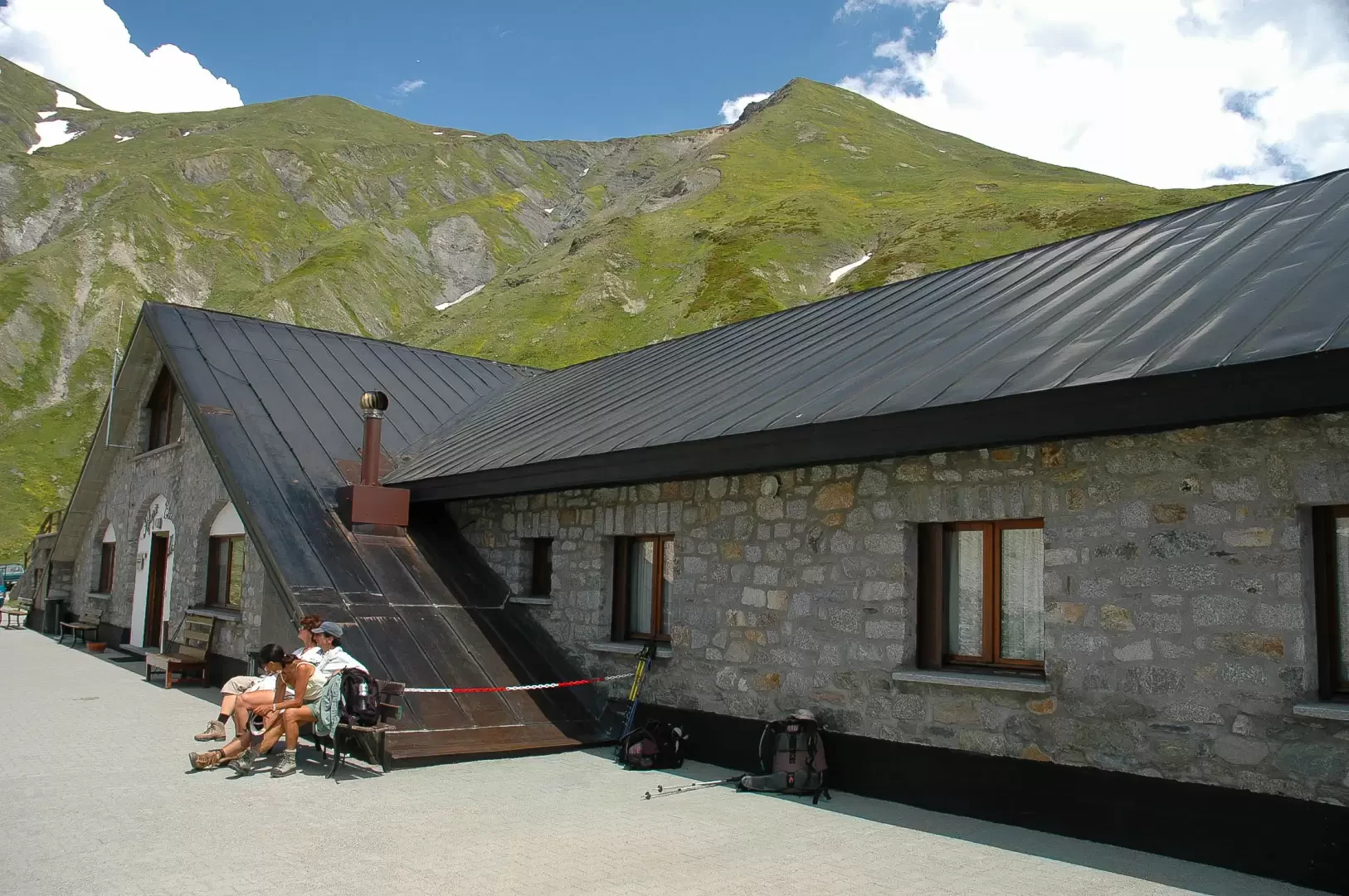
This itinerary provides a perfect view of the Pré de Bard glacier: there is a poster inside the hut with various photos of the glacier so you can see how it has retreated over the years.
Description
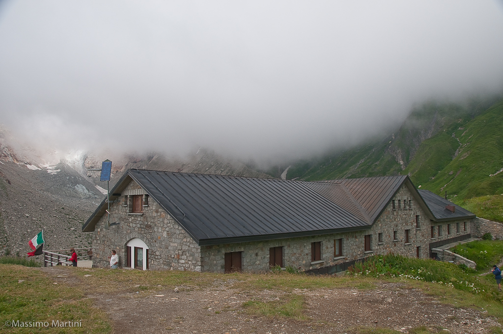
You park at Arnouva (1769m) just before the Val Ferret shuttle bus terminus (if the Val Ferret road is closed to traffic, you can get to Arnouva by shuttle bus). Leaving the car park, cross a small wooden bridge and start walking along a practically level farm road. After a few minutes, a signpost indicates the direction to take. Proceed for a short stretch on the level until you reach the junction for the Bivacco Comino (1785m, 0h10'): ignore the path and proceed along the road, which begins to climb. A splendid view of the Triolet glacier slowly opens up. The trail briefly skirts a branch of the Doire de Ferret until reaching, at a hairpin bend, the start of the path to the Dalmazzi hut (1857m, 0h15'). A couple of hairpin bends take you slightly uphill, continuing halfway up the slope, passing under a sloping rock. After passing a couple of small hairpin bends, continue straight ahead again, heading towards a moraine tongue descending from the Pré de Bard glacier. Finally you reach three long hairpin bends from which you can already catch a glimpse of the hut: at the end of the last one you meet the junction for the Fiorio bivouacs (2038m, 0h40') after which you proceed slightly uphill, crossing a few small streams, until you meet, on the left, the start of the path for the Tête de Ferret. The itinerary is now finished, and after a few metres you reach the Rifugio Elena (2061m, 0h45').
The return is along the same route as the outward journey.