Antey-Saint-André

Edited by:
Massimo Martini
Access
Antey-Saint-André can be reached via the [A5] Turin–Aosta motorway, taking the Châtillon–Saint-Vincent exit. From the motorway exit, take the towards Valtournenche, which runs through the municipality, connecting the hamlets along the main valley route. The nearest railway station is Châtillon, on the Turin–Aosta line operated by Trenitalia (TI); from where a local public bus service runs to Valtournenche. The nearest airport is ‘Sandro Pertini’ in Turin-Caselle, whilst Malpensa Airport serves international flights. The main road network remains accessible even in winter; however, secondary roads leading to the higher-altitude hamlets may be subject to difficulties in the event of heavy snowfall.
Introduction
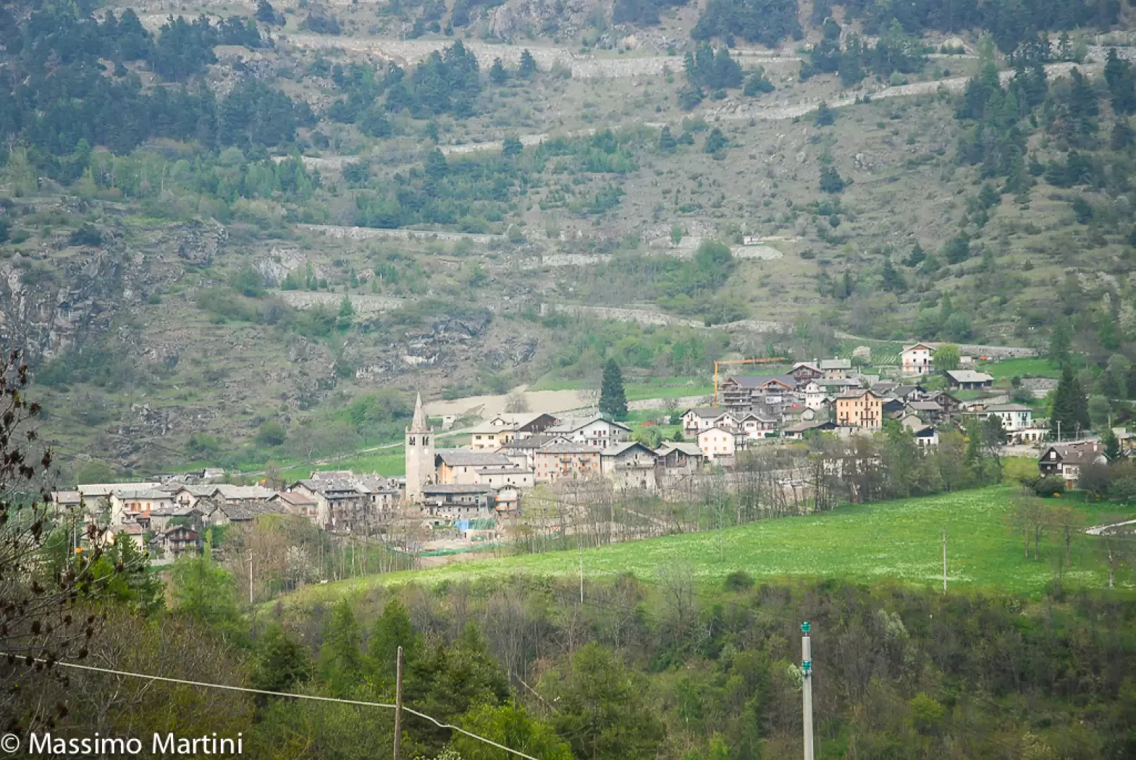
Antey-Saint-André is a municipality in the Aosta Valley, situated at the entrance to the Valtournenche, on the left bank of the Dora Baltea. The main town, the administrative centre of this scattered municipality, lies at an altitude of 1,074 metres, on a broad terrace that marks the transition between the lower central valley and the valley leading to the Matterhorn massif. The municipality borders Chamois, Châtillon, La Magdeleine, Saint-Denis, Torgnon and Valtournenche. Its open location, relatively sheltered from the prevailing winds, has encouraged the development of a stable settlement comprising numerous hamlets spread between the valley floor and the wooded slopes. Its role as the gateway to Valtournenche remains the defining feature of the municipality, which retains a dispersed settlement pattern and a well-established focus on outdoor activities.
Description
The municipal area stretches from the valley floor to the hills of Torgnon, La Magdeleine and Chamois, reaching its highest point at the Bois de Supplin. The geomorphological landscape is characterised by alluvial cones and terraces shaped by the Dora Baltea and its tributaries, primarily the Marmore, whose waters feed the Covalou hydroelectric power station, which came into operation in 1926 and is managed by CVA, which also utilises the diversions from the Gran Chamois, Torgnon, Antey and Promiod streams. The slopes are home to mixed forests of deciduous and coniferous trees, whilst the higher elevations are occupied by pastures and mountain pastures favoured by their sunny exposure.
Human presence in the area has been documented since the Neolithic period, through finds from the Roman burial ground at Navillod and artefacts discovered between Fiernaz and Antey – bronze fibulae, coins and pottery from the Classical period. The place name is probably of Roman origin, derived from the patronymic ‘Anthesius’, although there is no definitive documentary evidence to support this. In the Middle Ages, the area was ruled by the lords of Cly, a branch of the House of Challant, who in 1293 and 1304 granted privileges to the subjects of Antey and Torgnon; the area was definitively acquired by the House of Savoy in 1376, when Amadeus VI of Savoy expropriated the fiefdom to gain control of the route towards the Teodulo Pass and the Valais. In the centuries that followed, the barony passed to the Morales, Fabbri, Roncas, Bergera and Gozani d’Olmo families, until feudal ties were abolished in 1745. Between 1939 and 1946, the name of the municipality was Italianised to Antei Sant’Andrea. During the Second World War, the Valtournenche valley was the scene of operations by the ‘Marmore’ partisan brigade, commanded by Celestino Perron, and of German reprisals in October 1944, in which the partisan Giorgio Ravaz lost his life. The built heritage reflects these periods: the parish church of Sant’Andrea, traditionally believed to have been founded in the 6th century, first documented in a papal bull by Alexander III in 1176 and subject to renovations up until 1869; the freestanding bell tower, erected around 1555 on the remains of a tower belonging to the Barons of Cly; the Ru du Pain Perdu, a 16th-century irrigation canal whose stone arches, in the Grand Moulin area, remain visible from opposite sides of the valley; the Ethnographic Museum in the Maison Engaz, the former seat of the municipal magistracy. The settlement is divided into hamlets spread across the valley floor and the slopes: Bourg, home to the town hall and the parish church; Filey, with its sports ground; Buisson, the starting point of the cable car to Chamois, the only Italian municipality not accessible by ordinary road; Hérin and Nuarsaz, where rascards – traditional Alpine granaries made of stone and wood with mushroom-shaped supports to insulate the base from damp – are still preserved.
The traditional economy was based on cattle farming,subsistence farming – with apple cultivation as the characteristic crop – and on forestry, which historically produced clogs, figurines and rural artefacts, a tradition still alive in the Foire de l’artisanat in August, an exhibition by pupils from the Aosta Valley’s craft schools. The Fête des pommes, held on the second Sunday in October, is dedicated to local apple varieties and products made from them.
The most significant natural feature is Lake Lod, set amongst peat bogs and wet meadows, whose shores are colonised by Phragmites australis and other species characteristic of alpine wetlands, which serve as habitats for amphibians, reptiles and aquatic insects. Near the Filey sports area, the Coin Nature – an educational project known as RANA (Respect for the Natural Environment of Antey-Saint-André) – is a renaturalised wetland that is home to frogs, newts, water lilies and dragonflies, serving as a venue for environmental education.
From a hiking perspective, Antey-Saint-André serves as a base for routes linking the valley floor to the villages of La Magdeleine, Torgnon and Chamois, with routes leading up to mountain pastures and panoramic ridges, including the link to the Alta Via 1 and the Gran Balconata del Cervino. The network of footpaths also includes routes accessible to people with reduced mobility, such as the flat Path 8 between the village centre and the Liès picnic area. These same routes are suitable for mountain biking along the valley floor and towards the higher hamlets. The municipality is also the landing site for paragliding flights from the higher elevations of the Valtournenche valley.
Information
General information
Area: 11.68 km²
Altitude of the main town: 1,074 m
Highest point: 2,112 m – Bois de Supplin
Population: 557 (as at 31 May 2026)
Name in dialect: Antèy (in Aosta Valley patois)
Name of inhabitants: antesani
Patron saint: St'Andrew the Apostle, celebrated on 30 November
Villages and hamlets: Bourg, Filey, Buisson, Hérin, Nuarsaz, Fiernaz, Navillod, Liès
Neighbouring municipalities: Chamois – Châtillon – La Magdeleine – Saint-Denis – Torgnon – Valtournenche
Region: Aosta Valley
Country: Italy
Official website: Aosta Valley
Region: Italy
Country:
Country: Italy
Official website: comune.antey-st-andre.ao.it