Saint-Oyen

Edited by:
redazione
Access
Saint-Oyen can be reached via the [A5] Turin–Aosta motorway, taking the Aosta Est exit, from where you continue north on the Gran San Bernardo road; Until June 2027, the link between the motorway and the state road is closed for tunnelling works, so the route involves passing through the city of Aosta. The state road runs up the valley, passing through Gignod and Étroubles, and reaches the main town, situated along its route just before the junction for the tunnel and the Great St Bernard Pass. The main railway station is Aosta, on Trenitalia’s (TI) Chivasso–Aosta line; the section between Aosta and Ivrea is closed for electrification works and is served by replacement buses, with a phased reopening scheduled to begin in January 2027. Local public transport is operated by Arriva Italia, which runs a suburban service between Aosta and Saint-Rhémy-en-Bosses. The nearest airport with scheduled flights is Turin-Caselle’s “Sandro Pertini” Airport. The valley is one of the snowiest areas in the region: during the winter months, winter tyres or snow chains must be carried in the vehicle.
Introduction
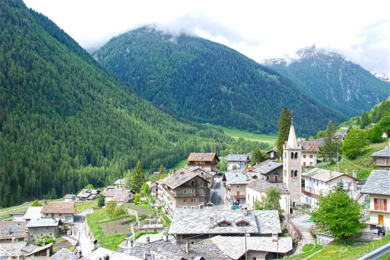
Saint-Oyen is a municipality in the Aosta Valley, situated in the upper Gran San Bernardo Valley, between Étroubles and Saint-Rhémy-en-Bosses, along the road leading to the Gran San Bernardo Pass and tunnel. The main town lies in the valley floor, on both banks of the Artanavaz stream, just below 1,400 metres, whilst the municipality extends up both slopes to the ridge marking the border with Valais, at over 2,700 metres. The municipality borders Étroubles, Gignod and Saint-Rhémy-en-Bosses and, across the border, Bourg-Saint-Pierre. Its history is linked to the passage of travellers and pilgrims heading for the pass along the route of the Via Francigena.
Description
The area covers a stretch of the Artanavaz valley floor and the two slopes bordering it: on the sun-facing side lie meadows and pastures, whilst the shaded side is home to larch and fir forests. From the valley floor, the Barasson valley and the Flassin cirque rise up to the boundary ridge. The villages, including Flassin, Château-Verdun, Condémine, Cerisey, Le Crétoux and Barasson, are scattered along the valley floor, on the lower terraces and in the mountain pastures of the valleys.
The place name derives from ‘Oyend’, the French form of ‘Eugendo’, abbot of the monastery of Condat in the Jura between the 5th and 6th centuries, whose veneration was introduced into the valley by Benedictine monks. The first recorded mention of the place dates back to 1137, when Count Amadeus III of Savoy donated the lands of Château-Verdun – which at that time were part of the parish of Étroubles – to the provostry of the Great St Bernard; the fortified house became a stopping point for travellers between Aosta and the pass and is still owned by the canons, who use it as a guesthouse and host a community of Benedictine nuns there. In 1584, the territory became part of the barony of Gignod. The parish church of Sant’Eugendo, probably founded in the 12th century and rebuilt in 1820, houses a 17th-century silver reliquary, partially gilded, the work of a Swiss artist. The village is home to the birthplace of Jean-Antoine Pellissier, an 18th-century monk who died in Naples, and the old Prenoud sawmill; the municipal library houses a 19th-century herbarium. Stendhal has the protagonist of *La Vie de Henri Brulard* pass through Saint-Oyen in his account of the descent from the Great St Bernard Pass.
The traditional economy was based on agriculture, livestock farming and services linked to traffic along the mountain pass road. The municipality’s signature product is Saint-Oyen charcoal-grilled ham, recognised as a traditional agri-food product. In Flassin there is a cross-country skiing centre, with trails linking Étroubles and Saint-Rhémy-en-Bosses, and in winter a snow play area is set up. The municipality takes part in the Coumba Freida Carnival and is part of the Unité des Communes valdôtaines Grand-Combin.
The area forms part of the Gran San Bernardo Valley wildlife reserve, home to red deer (Cervus elaphus) and roe deer (Capreolus capreolus) in the wooded areas, the ibex (Capra ibex) and the chamois (Rupicapra rupicapra) on rocky slopes, and several breeding pairs of golden eagles (Aquila chrysaetos).
The footpaths run along both sides of the valley, once also used by smugglers heading for the Valais. The summer routes lead to Plan Puitz and the Flassin cirque, whilst the Barasson valley leads to the border ridge and the Tête de Barasson. The Via Francigena runs through the valley floor, linking Saint-Oyen to Étroubles via the Bois de Gorrey and continuing on to Saint-Rhémy-en-Bosses and the pass.
Information
General information
Area: 9.42 km²
Altitude of the main town: 1,373 m
Highest point: 2,729 m – Tête de Barasson
Population: 188 (as at 1 January 2026)
Name in dialect: Sent-Oyèn
Name of inhabitants: saintoyards
Patron saint: Sant'Eugendo, celebrated on 2 January
Neighbouring municipalities: Bourg-Saint-Pierre (Switzerland) – Étroubles – Gignod – Saint-Rhémy-en-Bosses
Region: Aosta Valley
Country: Italy
Official website: municipality.saint-oyen.ao.it