Machaby's Corma, from the Machaby car park


Edited by:
Massimo Martini
Updated at: 02/09/2025
Access
Leave the motorway at the Verrès exit and turn right onto the main road in the direction of Turin. After passing the village of Verrès, after about 4 kilometres you will reach the Arnad roundabout. Take the second exit and continue towards the town centre, following the signs for the Machaby sanctuary. Follow the communal road for about 2.2 kilometres, skirting the Romanesque church of San Martino and passing near the Valleise Castle, until you reach the junction for the Machaby parking area. Continue straight for about 700 metres until you come to a large free parking area 🅿️ where you can leave your car. In the area, there is a panel with directions to the municipal footpath network.
Distance and walking time
🕒Travel time: 11 minutes
📏 Distance: 6.9 km
GPS navigation
📍 How to get there with Google Maps
📍 How to get there with Apple Maps
ℹ️ Important note
The information provided has been checked on the date of the survey of the route. Before departure, it is advisable to check for any changes to the route. For up-to-date and detailed directions, we recommend the use of Google Maps or Apple Maps.
Introduction
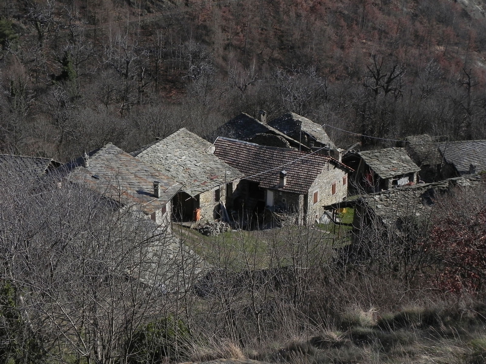
This short but evocative hike leads to the Corma di Machaby, a small rocky rise overlooking the torrent de Va valley and the village of the same name. The route follows the ancient mule track known as Pavià du Bioley, carefully paved and flanked by chestnut woods, witness to a time when these tracks were daily routes of communication.
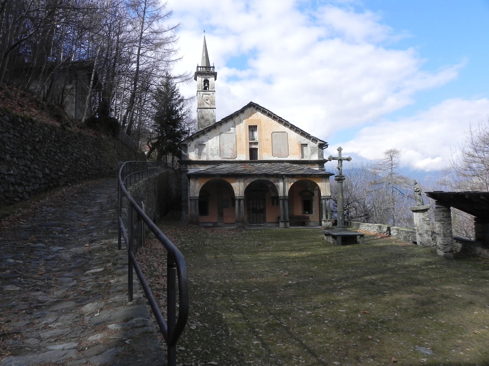
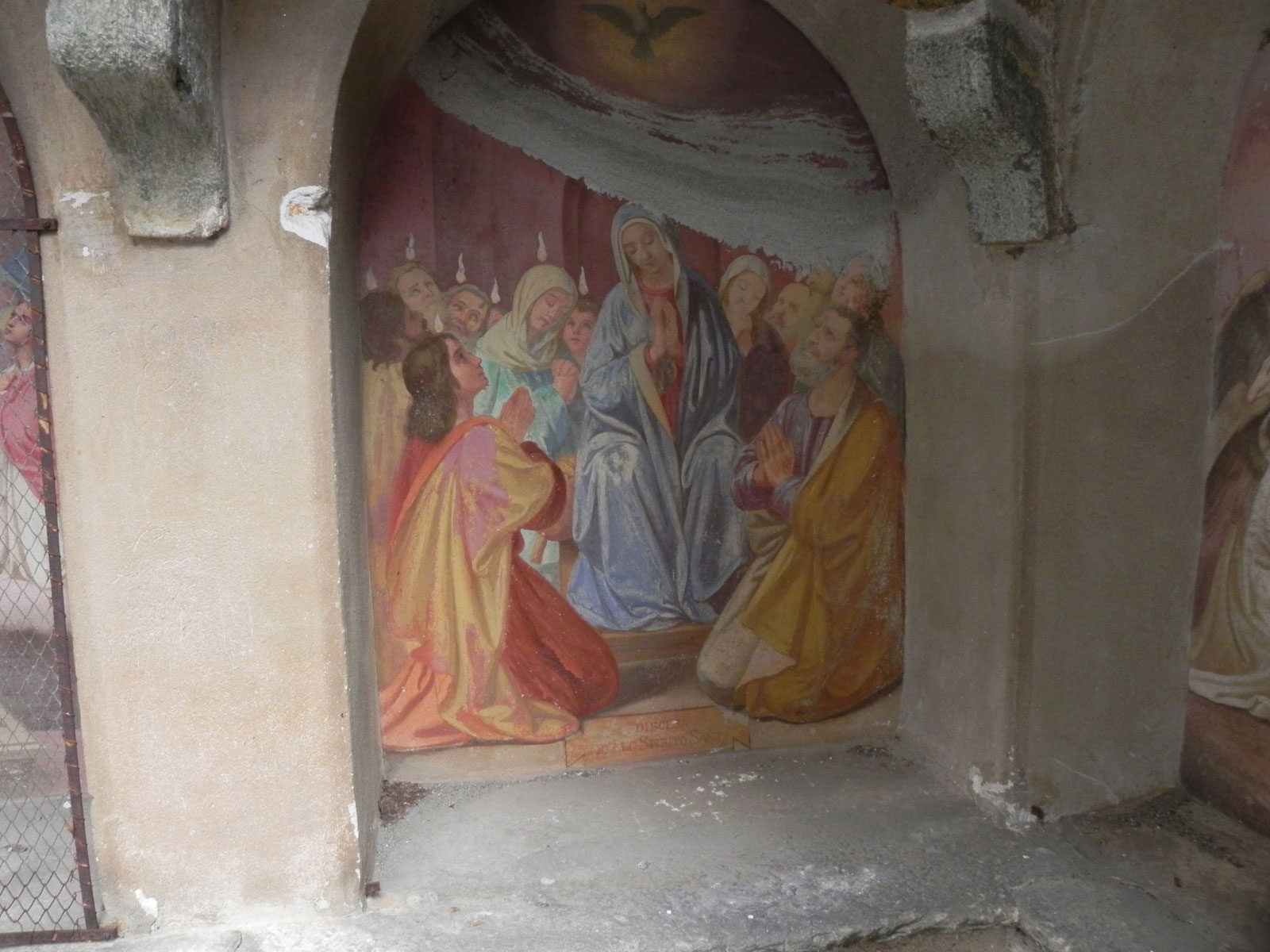
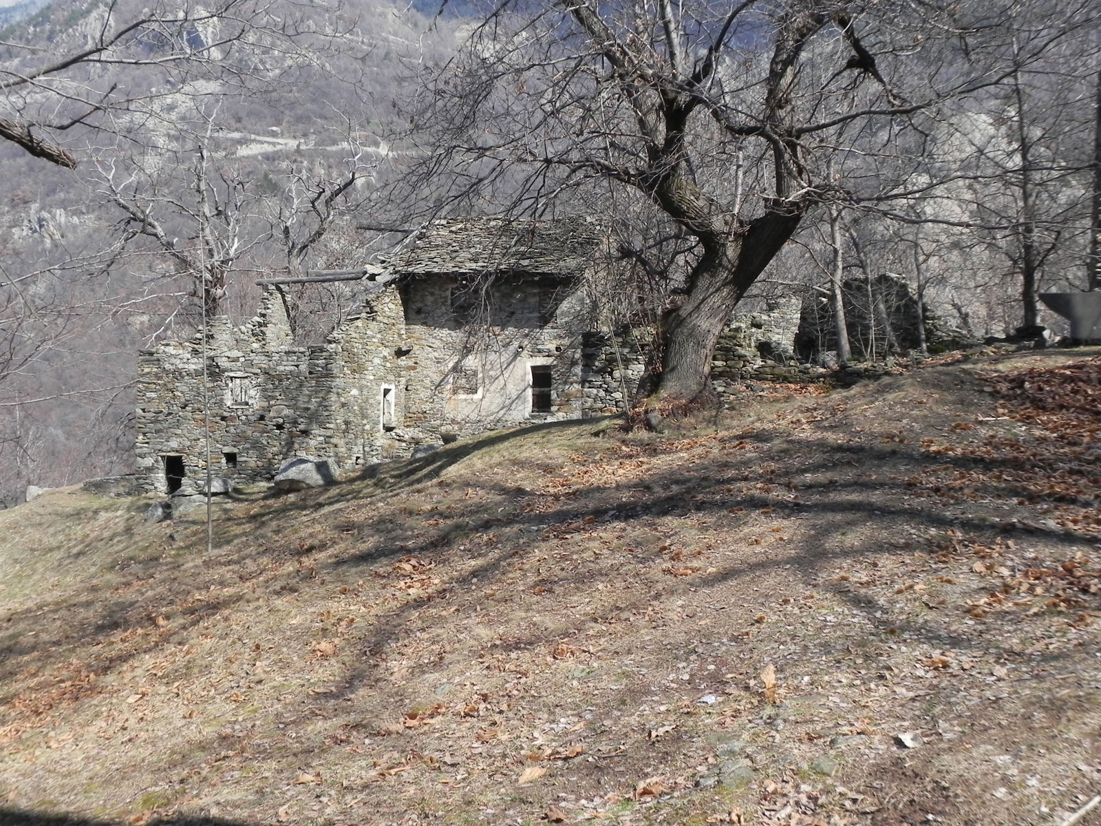
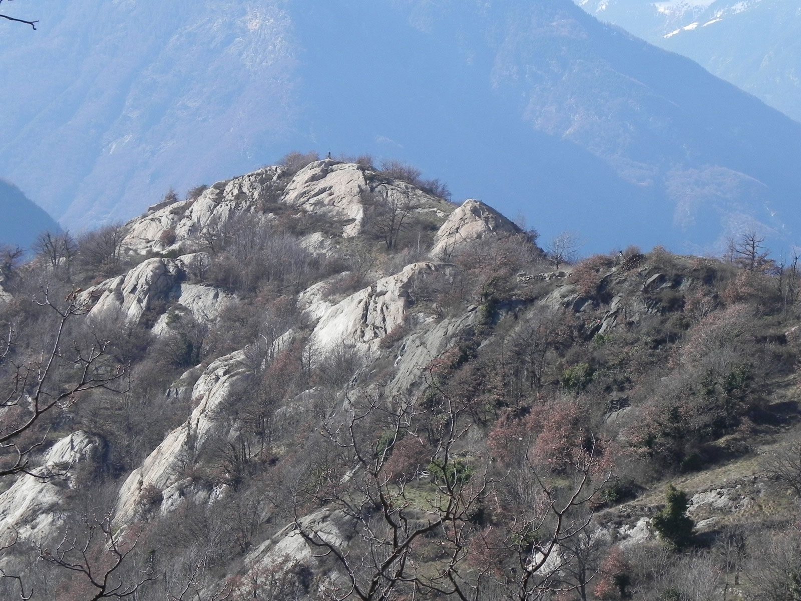
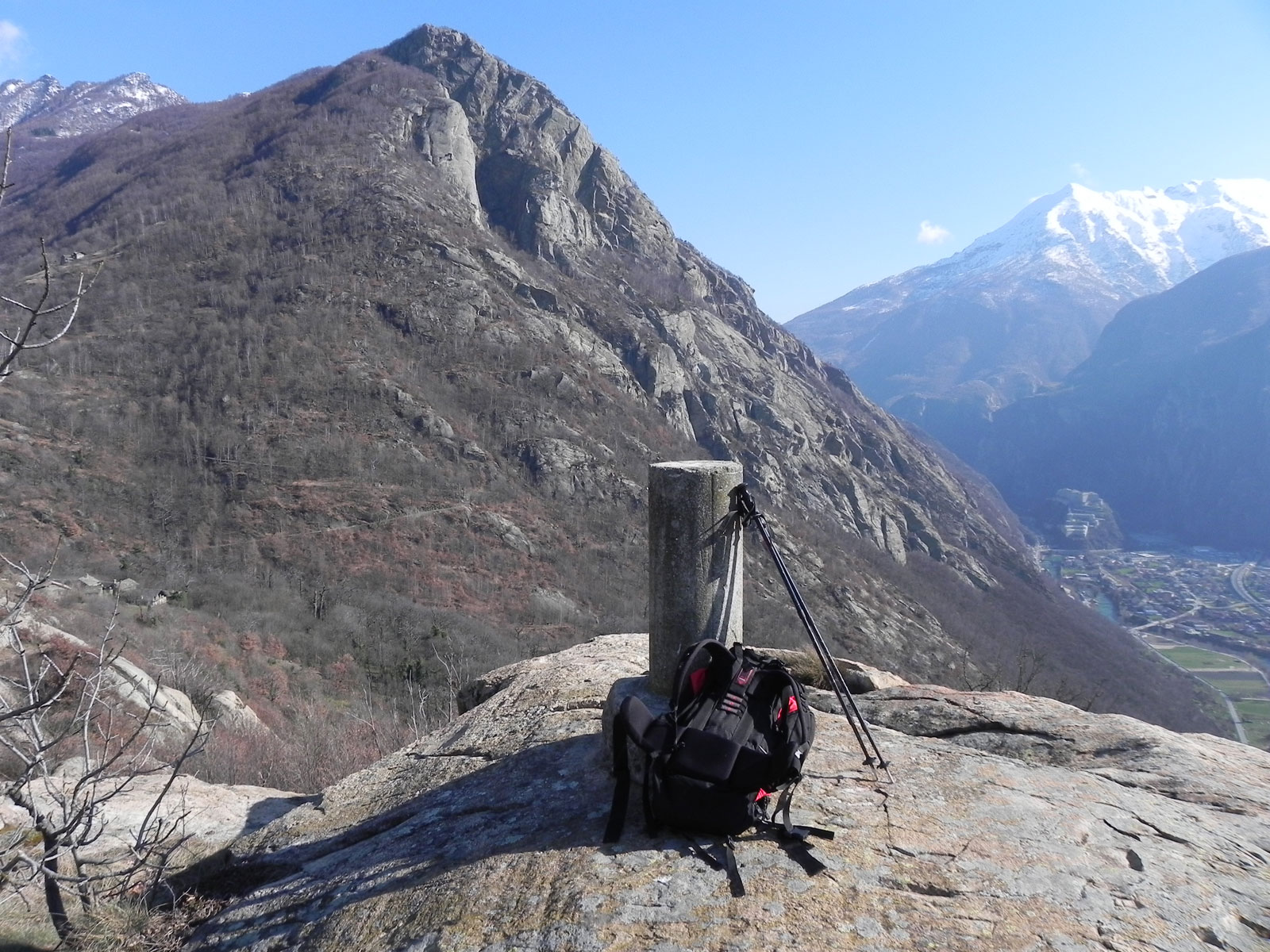
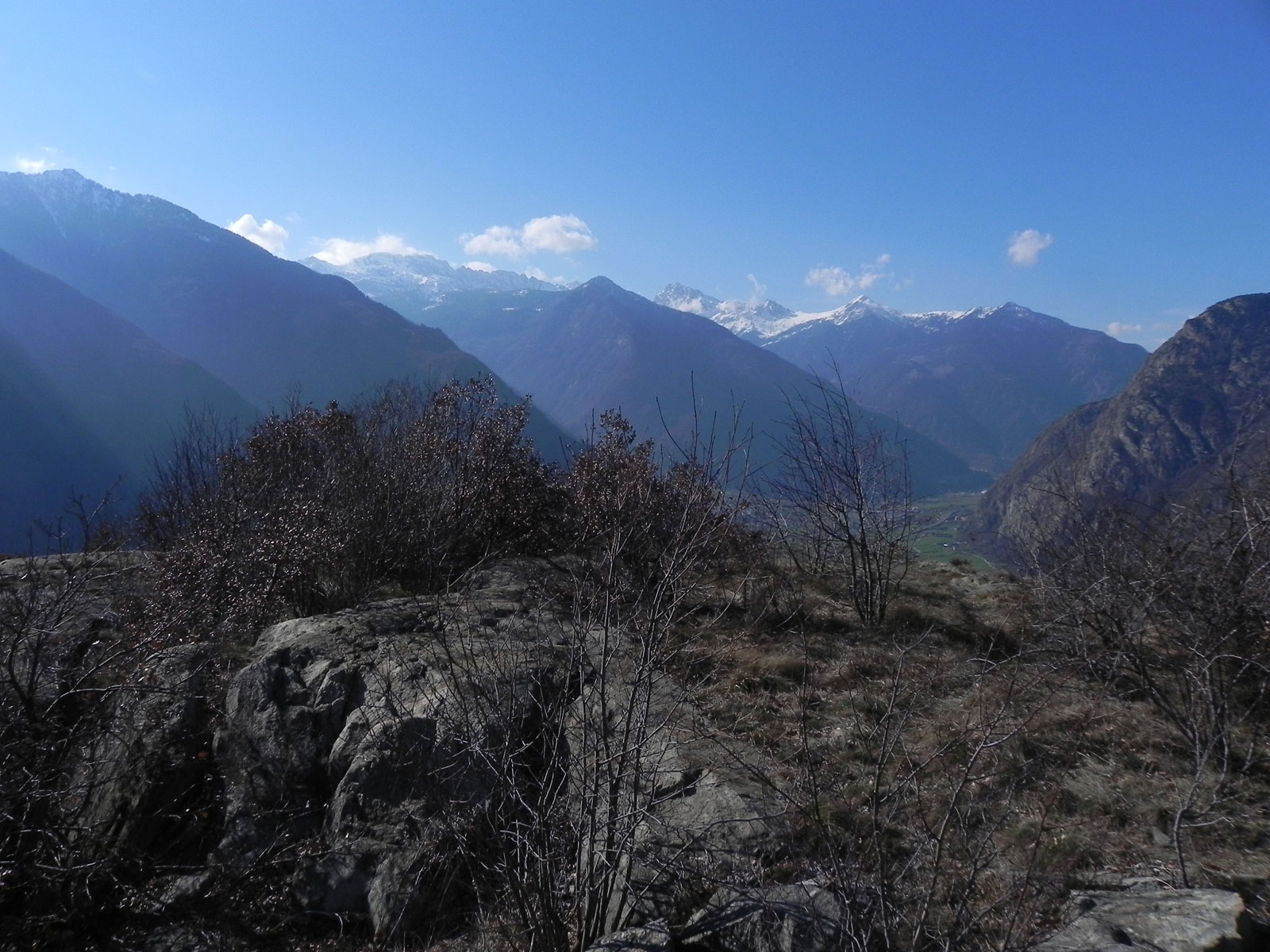
From the valley floor, it is a short walk to the Machaby Sanctuary, a place dear to popular devotion, and then continues along paths that become progressively narrower and more secluded, between oratories, dry stone walls and strips of oak forest. The summit of the Corma, surmounted by a stone cippus, offers a silent cue to contemplate from above a landscape that blends nature and traces of mountain life.
A simple and accessible itinerary, ideal for those seeking a short walk but rich in atmosphere and history.
Description
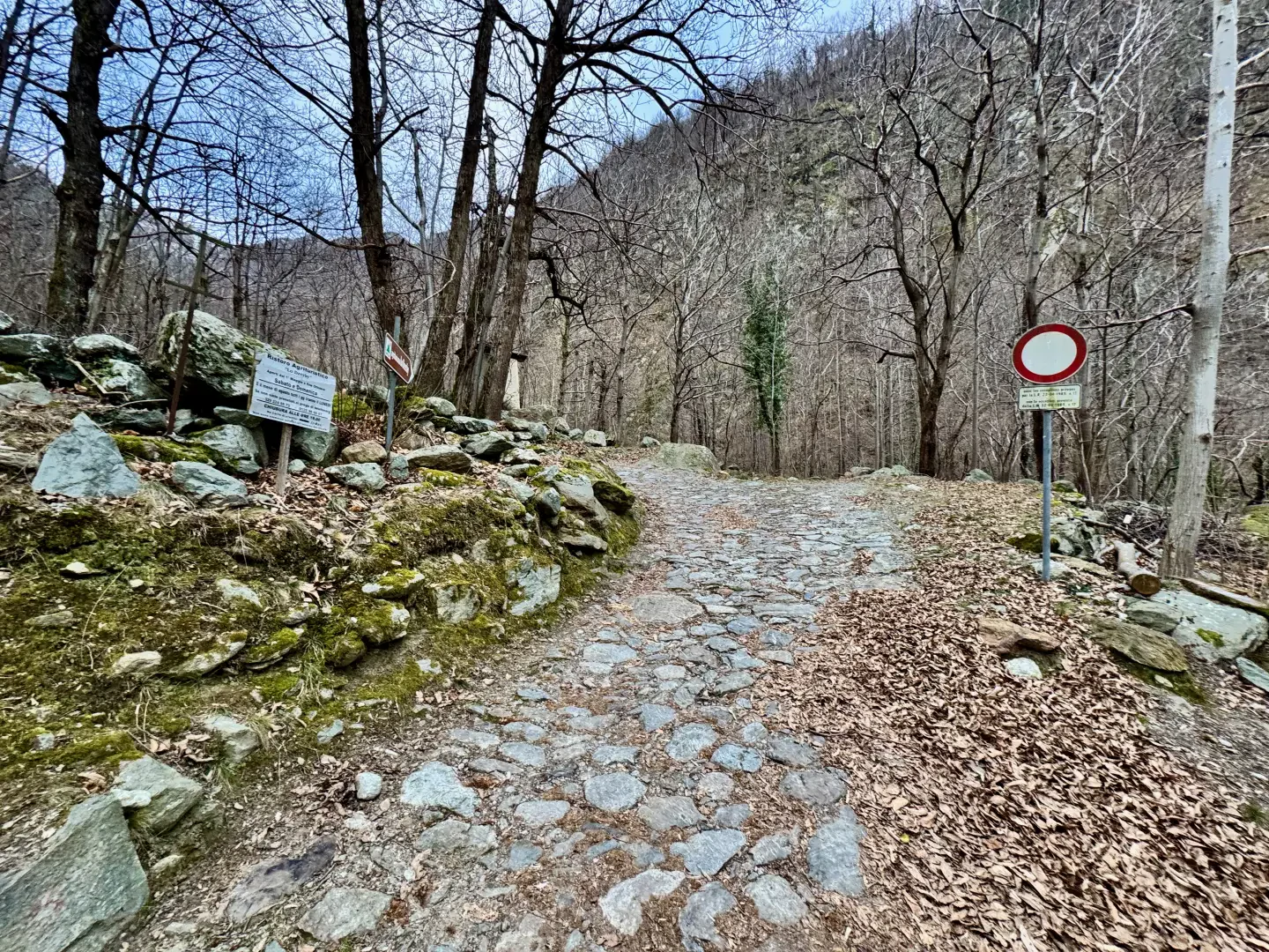
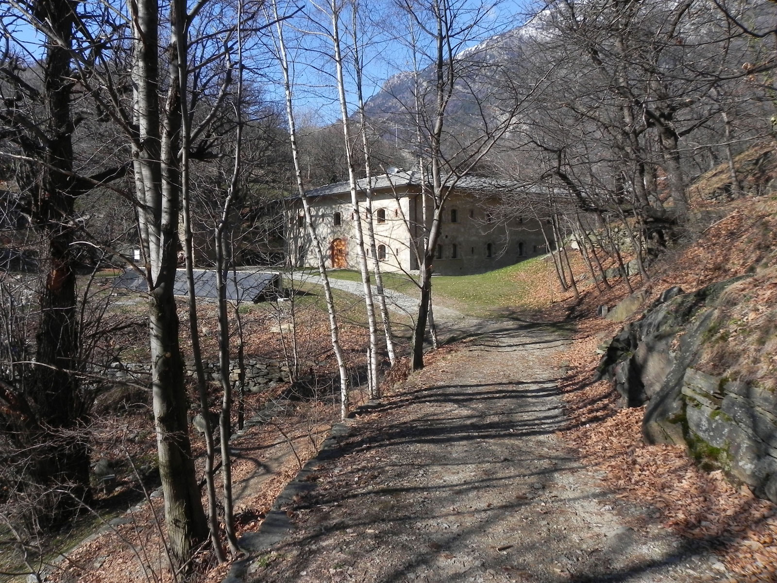
0h00' 0.00km Descend along the road until you reach a marker indicating path . Turn left and take the wide paved mule track, named Pavià du Bioley, which leads to Machaby. On the left, you will immediately come across a small tzapelet dedicated to Our Lady and Saints Martin and Barbara. Continue a little further until you reach a wooden bridge, cross the torrent de Va and resume the ascent along the pretty paved mule track that enters the thick chestnut forest (Castanea sativa). After a hairpin bend to the right, follow the mule track that continues steadily and moderately uphill until you reach the Machaby Sanctuary (685m).
0h20' 0.61 km Continue straight ahead on the mule track and, in a few minutes, you will reach an oratory dedicated to Our Lady and a fork in the road.
0h25' 0.81 km Keep right and follow the path on a level surface until you reach another fork in the road. Take a small path to the right that leads above the village of Machaby in a couple of bends. Continue now with a moderate slope and some ups and downs until you come to a barely visible fork. Keep to the right again and ascend a short distance until reaching a dry stone masonry wall, turn slightly to the left and ascend the slope between a few sparse oaks (Quercus pubescens) until reaching the summit of the Corma di Machaby () topped by a stone cippus 0h40' 1.44km .
The return follows the same route as the outward journey, retracing the path until returning to the starting point at the Machaby car park 0h20' 1.44km .
Points of Interest
Collections
Photo gallery
We have been there

Edited by:
Marcello Rossi
Corma di Machaby, dal parcheggio di Machaby
Dal piazzale si imbocca l’ampia via (ex-strada militare) che con tre tornanti porta al santuario di Machaby. Al santuario si imbocca la strada che si stacca alla sinistra del piazzale ed in pochi minuti si giunge al paese di Machaby; al bivio si imbocca la via che scende passando davanti all’edificio della fortificazione del Tenente Lucini, alla fine del quale si tende a sinistra e si prende la strada che tende a salire (seguendo le indicazioni riportate su cartelli in legno). Con una serie di tornanti, in circa venti minuti, si giunge all’ampio spiazzo della batteria di Machaby. Deviazione per il Corno di Machaby Se si vuole salire al Corno di Machaby, si deve tornare al bivio, proseguire verso le ultime costruzioni del paese e imboccare l’evidente sentiero che sale dalle case che in breve porta alla panoramica vetta del Corno con un piccolo ometto di vetta e belle viste sulla valle centrale. Avvistamenti floristici: Crocus
Note Storiche La costruzione del santuario di Machaby risale agli inizi del 1500 (prime notizie a partire dal 1503); dalla fine del seicento il santuario è stato via via ingrandito conservando dell’edificio originale il presbitero. L’altare principale risale al XVII secolo, mentre i due altari presenti nelle navate laterali risalgono al XVIII secolo. Caratteristica del santuario è quella di conservare numerosi ex-voto. Alle spalle del santuario in una serie di nicchie esterne sono affrescate diverse scene del mistero del Rosario. In generale la gita si svolge su di una strada militare di età napoleonica che serviva numerose fortificazioni costruite a supporto del forte di Bard, tra le quali il forte Tenente Lucini (oggi ristrutturato ed adibito ad ostello) e la batteria di Machaby, utilizzata anche come rifugio dai partigiani durante la seconda guerra mondiale.
Comments (0)
Sign in to leave a comment