Valpelline

Edited by:
redazione
Access
Valpelline can be reached via the [A5] Turin–Aosta motorway, taking the Aosta Est exit, from where you continue north along the Valpelline road, which follows the Buthier valley floor up to the main town; Until June 2027, the link between the motorway and the main road is closed for tunnelling works, and the route involves passing through the city of Aosta. From the main town, the regional road continues towards Oyace and Bionaz, whilst a branch road leads up to Ollomont. The main railway station is Aosta, on Trenitalia’s (TI) Chivasso–Aosta line; the section between Aosta and Ivrea is closed for electrification works and is served by replacement buses, with a phased reopening scheduled to begin in January 2027. Local public transport is operated by Arriva Italia, with suburban routes linking Aosta to the municipalities of Valpelline. The nearest airport with scheduled flights is Turin-Caselle’s “Sandro Pertini” Airport. The valley is one of the coldest in the region: during the winter months, winter tyres or snow chains must be carried in the vehicle.
Introduction
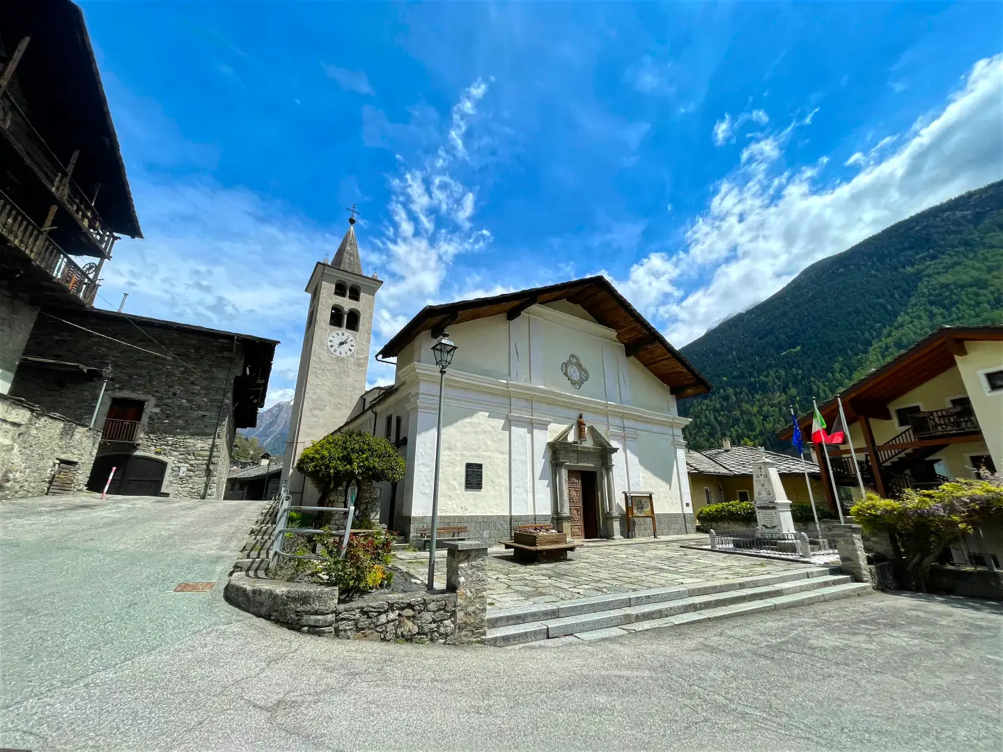
Valpelline is a municipality in the Aosta Valley, situated in the middle section of the valley of the same name, north of Aosta, and is its main centre. The main town lies in the Buthier valley floor, just below 1,000 metres, whilst the surrounding territory rises on both sides up to the ridges that separate it from the central valley and the side valleys, at altitudes exceeding 3,300 metres. The municipality borders Doues, Ollomont, Oyace, Quart, Roisan and Saint-Christophe. The valley, known locally as Combe Froide due to its harsh winter climate, remained isolated for a long time: a road suitable for carriages was not built until 1865.
Description
The area extends around the middle reaches of the Buthier and includes, on the left bank, the Foillou valley, where Lake Arpisson is situated at the foot of the Becca di Viou. The valley floor, narrow and partly wooded, widens around the main town and the principal villages, including Les Prailles, the municipal seat, Chozod, Thoules, Cheillon, Sémon and La Veulla. The Ru Pompillard, an irrigation channel dating back to 1409, rises within the municipal boundaries and flows down towards Roisan; sections carved into the rock from the medieval period can still be seen along its course. The valley is prone to hydrogeological instability: in 1846, following days of heavy rain, landslides and mudslides claimed several lives, and the same conditions recurred on 15 October 2000, though without any loss of life.
Reliable records of the settlement date back to the medieval period, when the territory was held in fief by the De La Tour family, who built a fortified house next to the present-day parish church. The barony comprising Quart, Valpelline and Oyace, which belonged to the De Porte lords, was one of the most important in the Duchy of Savoy. A remnant of this feudal era is the Tornalla, a circular tower built in the 15th century, which still houses a spiral staircase. Between the 18th and 19th centuries, a foundry owned by the Perrone di San Martino family operated not far from the village, processing ore extracted from the valley’s copper mine: its remains are now in ruins. Linked to the agricultural economy are a number of residences belonging to large landowners, including the houses of Constantin Ansermin and Jean-Pantaléon Gachet, both dating from the 18th century.
The traditional livelihood has been mountain farming, supplemented over time by summer tourism and cross-country skiing. In the second half of July, the patron saint’s festival of Saint Pantaleon is celebrated with the festival of ‘seupa à la vapelenentse’, a soup made with bread, fontina cheese and broth which takes its name from the municipality and was awarded the De.C.O. label in 2007. Valpelline is part of the ‘Unité des Communes valdôtaines Grand-Combin’, of which it is the administrative centre.
The fauna is distributed according to the valley’s altitudinal zones. In the cultivated valley floor and in the deciduous woods, the roe deer (Capreolus capreolus), the fox (Vulpes vulpes), the badger, the squirrel, the dormouse and, amongst the reptiles, the green whip snake, the grass snake and the common viper. In the mid-altitude forest, one may encounter the marten, theermine, the green, red and black woodpeckers, and the red deer (Cervus elaphus), whose numbers have increased in recent years. Above 2,000 metres, towards the Foillou valley, live the marmot (Marmota marmota), the mountain hare, the rock ptarmigan, the black grouse and the rock partridge, whilst the chamois (Rupicapra rupicapra) moves between the larch zone and the high pastures. Among the diurnal birds of prey, the buzzard (Buteo buteo) frequents the woodland, whilst thegolden eagle (Aquila chrysaetos) the higher altitudes.
The main town is the starting point for routes to the Foillou valley and Lake Arpisson, and for trails along the Ru Pompillard, which are accessible for most of the year. From the valley floor, you can reach the mountain pastures on both sides of the valley and, continuing further into the valley, the valleys of Ollomont, Oyace and Bionaz.
Information
General information
Area: 31.45 km²
Altitude of the main town: 964 m
Highest point: 3,332 m – Punta Fiorio
Population: 577 (as at 1 January 2026)
Name in the local dialect: Vapeleunna
Name of the inhabitants: Valpellinois
Patron saint: Saint Pantaleon, celebrated on 27 July
Neighbouring municipalities: Doues – Ollomont – Oyace – Quart – Roisan – Saint-Christophe
Region: Aosta Valley
Country: Italy
Official website: comune.valpelline.ao.it