Allein

Edited by:
redazione
Access
Allein can be reached via the [A5] Turin–Aosta motorway, taking the Aosta Est exit, from where you follow the signs for the Great St Bernard Pass along the Great St Bernard Pass road heading north. Once past the village of Gignod, take the road to Allein, which climbs the left-hand side of the valley to the main town and its hamlets. The main railway station is Aosta, on Trenitalia’s (TI) Chivasso–Aosta line; the section between Aosta and Ivrea is closed for electrification works and is served by replacement buses, with a phased reopening scheduled to begin in January 2027. Local public transport is operated by Arriva Italia, with suburban routes connecting Aosta to the towns in the Great St Bernard Valley. The nearest airport with scheduled flights is Turin-Caselle’s “Sandro Pertini” Airport. During the winter months, the regional road may have sections covered in snow or ice and requires winter tyres or snow chains to be carried on board.
Introduction
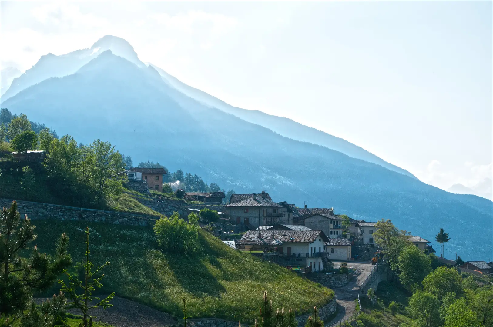
Allein is a municipality in the Aosta Valley situated on the orographic left-hand side of the Great St Bernard Valley, north of Aosta, along the route leading to the Great St Bernard Pass and tunnel. The main town, Le Plan-de-Clavel, lies halfway up the slope on a grassy terrace, whilst the municipality’s territory rises from the woods near the valley floor, just below 1,000 metres, up to the ridges of Mont Saron, at over 2,600 metres. The municipality borders Gignod, Doues and Étroubles and comprises numerous villages and rural hamlets scattered along the slope. The community’s identity is linked to cattle farming, cheese production, woodworking and the carnival traditions of the Coumba Freida, shared with neighbouring villages.
Description
The municipal area covers the slope that rises from the Artanavaz stream – a tributary of the Buthier – towards the summit ridges. The landscape is alpine in character, with terraced slopes and hay meadows at lower altitudes, pastureland in the middle zone and high-altitude grasslands above 2,000 metres, where scree and rocks are exposed. The wooded areas, consisting mainly of conifers, occupy the mid-slopes. The settlement is divided into numerous hamlets, including Ayez, Allamanaz, Bruson, Chez-Norat, Clavel, Daillon, Frein, Les Godioz and La Ville, scattered along the local road network and characterised by the rural architecture typical of the Aosta Valley, with stone buildings, wooden barns and slate roofs.
In Roman times, the area was crossed by the road that wound its way up the valley towards the Great St Bernard Pass and Octodurus, now known as Martigny; evidence of habitation from this period is provided by the discovery, in 1856, of a group of silver coins from the Republican era, some of which are preserved at the Académie Saint-Anselme museum in Aosta. The place name has been subject to various interpretations: the scholars Aebischer and Olivieri trace it back to the Latin personal name Allius, via the form Allianus; Carla Mercato has revived the traditional etymology ‘ad lignum’, referring to the village’s location on the edge of a wooded area; another hypothesis links it to a settlement of the Alans, a Sarmatian people documented in the Western Alps in the 5th century. In the Middle Ages, the territory was under the jurisdiction of the Lordship of Gignod; in 1242, judicial rights passed to the lords of Quart, who returned them to the House of Savoy in 1378. In 1543, Duke Charles II of Savoy separated Allein and Doues from the lordship of Gignod and enfeoffed them to Nicolas de la Crête; in 1574, the territory passed to François de la Crête, Secretary of State to Charles Emmanuel I and Baron of Gignod, whose estates passed to the Pallavicino-La Crête family until the end of the 18th century. In 1939, the name was Italianised to Alleno; the form ‘Allain’, restored in 1946, was replaced by the current spelling in 1976. The built heritage includes the 15th-century fortified house at Ayez, built of stone masonry with windows featuring an inverted keel motif, which houses the Coumba Freida Carnival Museum, and a 16th-century house in Allamanaz. In La Ville, on the site of the ancient church, a fragment of wall bears the inscription ‘Maria anno MVII leprosis laboravit’, considered the oldest evidence of leprosy in the Aosta Valley. The parish, mentioned at the beginning of the 14th century in the synodal constitutions of the Blessed Emerico di Quart, is based in the Church of Santo Stefano, consecrated in 1841, with a façade featuring four pilasters topped by a tympanum and a bell tower with a spire.
The local economy has traditionally been based on cattle farming and dairy production, centred on Fontina PDO, alongside a long-established tradition of artisan woodworking. On the last weekend of August, the Fëta di Trifolle takes place, dedicated to mountain potatoes and the preparation of Sorsa d’Allein. The municipality takes part in the Coumba Freida Carnival, during which the landzette of Allein stand out for the predominant red of their costumes, inspired by the uniforms of theNapoleonic army that passed through the valley in 1800 and decorated with mirrors, feathers and fringes. Allein is part of the Unité des Communes valdôtaines Grand-Combin.
The area falls within the Gran San Bernardo Valley wildlife reserve, which also includes Étroubles, Saint-Oyen and Saint-Rhémy-en-Bosses. In its wooded areas, the valley is home to one of the region’s largest populations of red deer (Cervus elaphus) in the region, alongside the roe deer (Capreolus capreolus). On the higher, rocky slopes, towards Mont Saron, the ibex (Capra ibex) and the chamois (Rupicapra rupicapra), the latter'sthe latter of which is also on the rise, partly due to the protected areas established in the valley. Among the diurnal birds of prey, several pairs of golden eagles (Aquila chrysaetos), whilst the buzzard (Buteo buteo) is the most widespread species. Recent traces of the lynx (Lynx lynx) have been found in the valley, though there is no confirmation of a permanent presence.
The network of footpaths connects the hamlets to the higher mountain pastures and the ridges of Mont Saron, and allows visitors to reach the neighbouring communes of Doues and Gignod on foot. In the mountain pasture area, near Baravex Damon, lies the Dortoir Baravex, an accommodation facility that can also be reached via a circular route from La Ville. In the winter months, these same slopes are traversed on snowshoes all the way to the dortoir.
Information
General information
Area: 7.96 km²
Altitude of the main town: 1,190 m
Highest point: 2,681 m – Mont Saron
Population: 197 (as at 1 January 2026)
Name in the local dialect: Alèn
Name of the inhabitants: allençois
Patron saint: Saint Stephen, celebrated on 26 December
Neighbouring municipalities: Doues – Étroubles – Gignod
Region: Aosta Valley
Country: Italy
Official website: http://www.gignod.it
Italy
Official website: comune.allein.ao.it